PilotArran
PilotArran
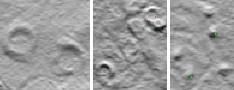
The island of Arran is a ‘Scotland in miniature’, representing the majority of landscape types and types of cultural heritage found elsewhere in Scotland. Airborne laser scanning data covering all of Arran, with an average of 2.8 ground points per square metre, was used to create a digital terrain model (DTM) with 20 cm pixel spacing. From accurate centre positions of known cultural heritage objects, or remains, that are visible in the DTM, 20 m × 20 m subimages are extracted. DTM subimages without cultural heritage remains are also extracted. The subimages are used for training the classifier. To increase the number of training images, flipped and rotated versions are created for each subimage.
The main part of the classifier is a deep neural network that has already been pre-trained on one million images of natural scenes. The final layer of the neural network produces a vector of presence/absence of natural scene objects. This layer is replaced by a support vector machine (SVM) classifier. The SVM classifier is trained as follows. The labelled DTM image extracts, some of which are centred on a single cultural heritage object, are fed through the deep neural network to produce a 1000 element feature vector for each image extract. The labelled feature vectors are then used to train the SVM classifier.
By cross-validation on the known cultural heritage remains, we expect that about 90% of them may be successfully detected.
Latest project news
|
NR has signed a contract with Historic Environment Scotland to perform a proof of concept study. The project seeks to develop heavily automated analysis of digital topographic data to extract archaeological information and to expedite the creation of national-scaled mapping. Updated date: Onsdag, november 1, 2017 - 22:55 |
Contact information

Project period
Objectives
Financing
Historic Environment Scotland
Partners
Historic Environment Scotland
 Hvordan komme til NR
 Del på sosiale media
 Personvernerklæring