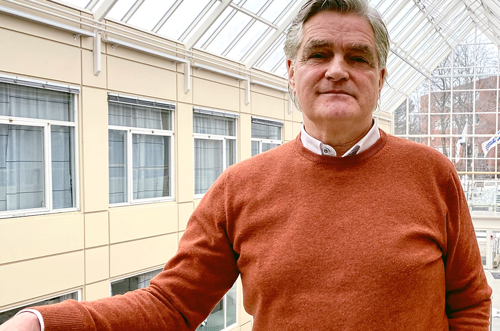
Publication profile
Publication profile
Jarle Hamar Reksten
Name:
Jarle Hamar Reksten
Title:
Seniorforsker / Senior Research Scientist
Phone:
(+47) +47 22 85 25 85
Email:
jarlebh [at] nr [dot] no
Scientific areas:
Remote sensing, Pattern recognition, Image analysis, Machine learning, Deep learning, Automatic speech recognition

Add to contacts (vCard) Show publications
Academic article
2021
Automated mapping of cultural heritage in Norway from airborne lidar data using faster R-CNN. International Journal of Applied Earth Observation and Geoinformation (ISSN 1569-8432). 95 pp 1-19. doi: 10.1016/j.jag.2020.102241. 2021.
. Estimating Traffic in Urban Areas from Very-High Resolution Aerial Images. International Journal of Remote Sensing (ISSN 0143-1161). 42(3) pp 865-883. doi: 10.1080/01431161.2020.1815891. 2021. Arkiv
. 2019
Flood detection in Norway based on Sentinel-1 SAR imagery. International Archives of Photogrammetry, Remote Sensing and Spatial Information Sciences (ISSN 1682-1750). XLII-3/W8 pp 349-355. doi: 10.5194/isprs-archives-XLII-3-W8-349-2019. 2019. Omtale
. Academic chapter/article/Conference paper
2018
Towards a national infrastructure for semi-automatic mapping of cultural heritage in Norway. In: Oceans of data. Proceedings of the 44th Annual Conference on Computer Applications and Quantitative Methods in Archaeology. (ISBN 9781784917302). pp 159-172. 2018. Fulltekst
. 2016
Automatic detection and mapping of avalanches in SAR images. In: Geoscience and Remote Sensing Symposium (IGARSS), 2016 IEEE International. (ISBN 978-1-5090-3332-4). pp 689-692. doi: 10.1109/IGARSS.2016.7729173. 2016. Fulltekst
. 2015
Combining NdHMM and Phonetic Feature Detection for Speech Recognition. In: Proceedings of European Signal Processing Conference. (ISBN 978-0-9928626-4-0). pp 1696-1700. doi: 10.1109/EUSIPCO.2015.7362667. 2015.
. 2013
Non-Negative Durational HMM. In: Proceedings of IEEE International Workshop on Machine Learning for Signal Processing 2013. (ISBN 978-1-4799-1180-6). doi: 10.1109/MLSP.2013.6661976. 2013.
. Academic lecture
2022
Automated mapping of cultural heritage in Norway from airborne lidar data using Faster R-CNN. Northern Lights Deep Learning Conference 2022; Tromsø, 1/10/2022 - 1/12/2022.
. Automated mapping of cultural heritage in Norway from airborne laser scanning data using Faster R-CNN. 41st EARSeL Symposium; Pafos, Kypros, 9/13/2022 - 9/16/2022.
. 2021
A new climate snow cover record based on ATSR-2 and AATSR. EUMETSAT 2021 Conference, 9/20/2021 - 9/24/2021.
. Development of a new 38-year time series of daily, global fractional snow cover products based on fusion of optical and passive microwave radiometer data. From Science to Operations for Copernicus Imaging Microwave Radiometer (CIMR) Mission, 5/11/2021 - 5/12/2021.
. 2019
Monitoring lake ice cover with Sentinel-3. ESA Living Planet Symposium; Milano, 5/13/2019 - 5/17/2019.
. 2018
Urban Traffic Density Estimation for Air Pollution Modelling using Deep Neural Networks. EARSeL - 5th Joint Workshop - "Urban Remote Sensing – Challenges & Solutions"; Bochum, 9/24/2018 - 9/26/2018.
. Local and regional trends in snow cover from a 34-year time series of satellite observations. 15th International Circumpolar Remote Sensing Symposium (ICRSS); Potsdam, 9/10/2018 - 9/14/2018.
. A portfolio of snow products based on Sentinel-3 for snow hydrology. SnowHydro – International Conference on Snow Hydrology; Heidelberg, 2/12/2018 - 2/15/2018.
. 2016
Preparing for a national service for flood monitoring using Sentinel-1. ESA Living Planet Symposium, 5/9/2016.
. Automatic detection and segmentation of avalanches in remote sensing images using deep convolutional neural networks. The 18th International Symposium on Symbolic and Numerical Algorithms for Scientific Computing, Geoinformatics Workshop, 9/27/2016.
. Towards a national infrastructure for semi-automatic mapping of cultural heritage in Norway. 44th Computer Applications and Quantitative Methods in Archaeology Conference (CAA 2016); Oslo, 3/29/2016 - 4/2/2016. Sammendrag
. 2008
SIRKUS - A new paradigm for speech recognition. VERDIKT Conference 2008; Bergen, 10/29/2008 - 10/30/2008.
. Poster
2018
Avalanche detection in sar images using deep learning. International Geoscience and Remote Sensing Symposium, IGARSS 2018; Valencia, 7/22/2018 - 7/27/2018.
. Local and regional trends in snow cover from a 34-year time series of satellite observations. 2018 EUMETSAT Meteorological Satellite Conference; Tallinn, 9/17/2018 - 9/21/2018.
. Report
2021
Utvikling av operasjonell snøtjeneste ved NVE. Resultater fra prosjektfase 3. Norsk Regnesentral. NR-notat SAMBA/37/21. pp 62. 2021.
. Snow Product User Guide. AI4Arctic guide to snow products V1. Norsk Regnesentral. NR-notat SAMBA/15/21. pp 26. 2021.
. Final report. AI4Arctic Deliverable 6. Norsk Regnesentral. NR-notat SAMBA/19/21. pp 78. 2021.
. 2020
Design and development toward a global flood monitoring product. GlobFlom report. Norsk Regnesentral. NR-notat SAMBA/49/20. pp 68. 2020.
. Dataset and data policy. AI4Arctic Deliverable 3. Norsk Regnesentral. NR-notat SAMBA/32/20. pp 44. 2020.
. Multi-sensor multi-temporal FSC 2017-2020 dataset. S4S multi-FSC prototype products to EDI, Version 2.0. Norsk Regnesentral. NR-notat SAMBA/24/20. pp 30. 2020.
. ICT requirements and API. AI4Arctic Deliverable 2. Norsk Regnesentral. NR-notat SAMBA/20/20. pp 24. 2020.
. 2019
Utvikling av operasjonell snøtjeneste ved NVE. Resultater fra prosjektfase 2. Norsk Regnesentral. NR-notat SAMBA/52/2019. pp 50. 2019.
. Utvikling av operasjonell flomtjeneste ved NVE. Resultater fra prosjektfase 3. Norsk Regnesentral. NR-notat SAMBA/09/2019. pp 42. 2019.
. System for deteksjon og kartlegging av flom basert på SAR. Norsk Regnesentral. NR-notat SAMBA/11/19. pp 20. 2019.
. Algorithms for flood detection and mapping by SAR. Algorithm Theoretical Basis Document, Flood Service System at NVE. Norsk Regnesentral. NR-notat SAMBA/10/19. pp 24. 2019.
. Utvikling av operasjonell innsjøistjeneste hos NVE: Resultater fra prosjektfase 2. Norsk Regnesentral. NR-notat SAMBA/45/19. pp 56. 2019.
. Automated detection of cultural heritage in airborne lidar data. CultSearcher operationalisation. Norsk Regnesentral. NR-notat SAMBA/50/19. pp 157. 2019.
. 2018
Further advancement of global snow mapping in CryoClim. Sentinel4CryoClim Phase 2 - Deliverables 1, 3-7. Norsk Regnesentral. NR-notat SAMBA/44/18. pp 82. 2018.
. Utvikling av operasjonell innsjøistjeneste hos NVE. Resultater fra prosjektfase 1. Norsk Regnesentral. NR-notat SAMBA/20/18. pp 37. 2018.
. 2017
Utvikling av operasjonell flomtjeneste ved NVE. Resultater fra prosjektfase nr. 1. Norsk Regnesentral. NR-notat SAMBA/07/2017. pp 34. 2017.
. Utvikling av operasjonell flomtjeneste ved NVE, Resultater fra prosjektfase 2. Norsk Regnesentral. NR-notat SAMBA/37/2017. pp 28. 2017.
. Semi-automatic detection of ice breeding seal pups. Norsk Regnesentral. NR-notat SAMBA/03/2017. pp 20. 2017.
. 2016
Tree species classification with airborne LiDAR and hyperspectral imaging. HyperBio Project Report 2016. Norsk Regnesentral. NR-notat SAMBA/60/16. pp 35. 2016.
. Oil spill detection using optical and thermal remote sensing data. Norsk Regnesentral. NR-notat SAMBA/55/16. pp 34. 2016.
. Application of remote sensing in cultural heritage management. CultSearcher project report 2015. Norsk Regnesentral. NR-notat SAMBA/08/16. pp 195. 2016. Fulltekst
. 2015
State-of-the-art review of oil spill detection using optical and thermal remote sensing data. Norsk Regnesentral. NR-notat SAMBA/14/15. pp 27. 2015.
.

Name: | Jarle Hamar Reksten |
Title: | Seniorforsker / Senior Research Scientist |
Phone: | (+47) +47 22 85 25 85 |
Email: | jarlebh [at] nr [dot] no |
Scientific areas: | Remote sensing, Pattern recognition, Image analysis, Machine learning, Deep learning, Automatic speech recognition |
![]() | Add to contacts (vCard) |
Show publications |
Academic article
2021
Automated mapping of cultural heritage in Norway from airborne lidar data using faster R-CNN. International Journal of Applied Earth Observation and Geoinformation (ISSN 1569-8432). 95 pp 1-19. doi: 10.1016/j.jag.2020.102241. 2021.
. Estimating Traffic in Urban Areas from Very-High Resolution Aerial Images. International Journal of Remote Sensing (ISSN 0143-1161). 42(3) pp 865-883. doi: 10.1080/01431161.2020.1815891. 2021. Arkiv
. 2019
Flood detection in Norway based on Sentinel-1 SAR imagery. International Archives of Photogrammetry, Remote Sensing and Spatial Information Sciences (ISSN 1682-1750). XLII-3/W8 pp 349-355. doi: 10.5194/isprs-archives-XLII-3-W8-349-2019. 2019. Omtale
. Academic chapter/article/Conference paper
2018
Towards a national infrastructure for semi-automatic mapping of cultural heritage in Norway. In: Oceans of data. Proceedings of the 44th Annual Conference on Computer Applications and Quantitative Methods in Archaeology. (ISBN 9781784917302). pp 159-172. 2018. Fulltekst
. 2016
Automatic detection and mapping of avalanches in SAR images. In: Geoscience and Remote Sensing Symposium (IGARSS), 2016 IEEE International. (ISBN 978-1-5090-3332-4). pp 689-692. doi: 10.1109/IGARSS.2016.7729173. 2016. Fulltekst
. 2015
Combining NdHMM and Phonetic Feature Detection for Speech Recognition. In: Proceedings of European Signal Processing Conference. (ISBN 978-0-9928626-4-0). pp 1696-1700. doi: 10.1109/EUSIPCO.2015.7362667. 2015.
. 2013
Non-Negative Durational HMM. In: Proceedings of IEEE International Workshop on Machine Learning for Signal Processing 2013. (ISBN 978-1-4799-1180-6). doi: 10.1109/MLSP.2013.6661976. 2013.
. Academic lecture
2022
Automated mapping of cultural heritage in Norway from airborne lidar data using Faster R-CNN. Northern Lights Deep Learning Conference 2022; Tromsø, 1/10/2022 - 1/12/2022.
. Automated mapping of cultural heritage in Norway from airborne laser scanning data using Faster R-CNN. 41st EARSeL Symposium; Pafos, Kypros, 9/13/2022 - 9/16/2022.
. 2021
A new climate snow cover record based on ATSR-2 and AATSR. EUMETSAT 2021 Conference, 9/20/2021 - 9/24/2021.
. Development of a new 38-year time series of daily, global fractional snow cover products based on fusion of optical and passive microwave radiometer data. From Science to Operations for Copernicus Imaging Microwave Radiometer (CIMR) Mission, 5/11/2021 - 5/12/2021.
. 2019
Monitoring lake ice cover with Sentinel-3. ESA Living Planet Symposium; Milano, 5/13/2019 - 5/17/2019.
. 2018
Urban Traffic Density Estimation for Air Pollution Modelling using Deep Neural Networks. EARSeL - 5th Joint Workshop - "Urban Remote Sensing – Challenges & Solutions"; Bochum, 9/24/2018 - 9/26/2018.
. Local and regional trends in snow cover from a 34-year time series of satellite observations. 15th International Circumpolar Remote Sensing Symposium (ICRSS); Potsdam, 9/10/2018 - 9/14/2018.
. A portfolio of snow products based on Sentinel-3 for snow hydrology. SnowHydro – International Conference on Snow Hydrology; Heidelberg, 2/12/2018 - 2/15/2018.
. 2016
Preparing for a national service for flood monitoring using Sentinel-1. ESA Living Planet Symposium, 5/9/2016.
. Automatic detection and segmentation of avalanches in remote sensing images using deep convolutional neural networks. The 18th International Symposium on Symbolic and Numerical Algorithms for Scientific Computing, Geoinformatics Workshop, 9/27/2016.
. Towards a national infrastructure for semi-automatic mapping of cultural heritage in Norway. 44th Computer Applications and Quantitative Methods in Archaeology Conference (CAA 2016); Oslo, 3/29/2016 - 4/2/2016. Sammendrag
. 2008
SIRKUS - A new paradigm for speech recognition. VERDIKT Conference 2008; Bergen, 10/29/2008 - 10/30/2008.
. Poster
2018
Avalanche detection in sar images using deep learning. International Geoscience and Remote Sensing Symposium, IGARSS 2018; Valencia, 7/22/2018 - 7/27/2018.
. Local and regional trends in snow cover from a 34-year time series of satellite observations. 2018 EUMETSAT Meteorological Satellite Conference; Tallinn, 9/17/2018 - 9/21/2018.
. Report
2021
Utvikling av operasjonell snøtjeneste ved NVE. Resultater fra prosjektfase 3. Norsk Regnesentral. NR-notat SAMBA/37/21. pp 62. 2021.
. Snow Product User Guide. AI4Arctic guide to snow products V1. Norsk Regnesentral. NR-notat SAMBA/15/21. pp 26. 2021.
. Final report. AI4Arctic Deliverable 6. Norsk Regnesentral. NR-notat SAMBA/19/21. pp 78. 2021.
. 2020
Design and development toward a global flood monitoring product. GlobFlom report. Norsk Regnesentral. NR-notat SAMBA/49/20. pp 68. 2020.
. Dataset and data policy. AI4Arctic Deliverable 3. Norsk Regnesentral. NR-notat SAMBA/32/20. pp 44. 2020.
. Multi-sensor multi-temporal FSC 2017-2020 dataset. S4S multi-FSC prototype products to EDI, Version 2.0. Norsk Regnesentral. NR-notat SAMBA/24/20. pp 30. 2020.
. ICT requirements and API. AI4Arctic Deliverable 2. Norsk Regnesentral. NR-notat SAMBA/20/20. pp 24. 2020.
. 2019
Utvikling av operasjonell snøtjeneste ved NVE. Resultater fra prosjektfase 2. Norsk Regnesentral. NR-notat SAMBA/52/2019. pp 50. 2019.
. Utvikling av operasjonell flomtjeneste ved NVE. Resultater fra prosjektfase 3. Norsk Regnesentral. NR-notat SAMBA/09/2019. pp 42. 2019.
. System for deteksjon og kartlegging av flom basert på SAR. Norsk Regnesentral. NR-notat SAMBA/11/19. pp 20. 2019.
. Algorithms for flood detection and mapping by SAR. Algorithm Theoretical Basis Document, Flood Service System at NVE. Norsk Regnesentral. NR-notat SAMBA/10/19. pp 24. 2019.
. Utvikling av operasjonell innsjøistjeneste hos NVE: Resultater fra prosjektfase 2. Norsk Regnesentral. NR-notat SAMBA/45/19. pp 56. 2019.
. Automated detection of cultural heritage in airborne lidar data. CultSearcher operationalisation. Norsk Regnesentral. NR-notat SAMBA/50/19. pp 157. 2019.
. 2018
Further advancement of global snow mapping in CryoClim. Sentinel4CryoClim Phase 2 - Deliverables 1, 3-7. Norsk Regnesentral. NR-notat SAMBA/44/18. pp 82. 2018.
. Utvikling av operasjonell innsjøistjeneste hos NVE. Resultater fra prosjektfase 1. Norsk Regnesentral. NR-notat SAMBA/20/18. pp 37. 2018.
. 2017
Utvikling av operasjonell flomtjeneste ved NVE. Resultater fra prosjektfase nr. 1. Norsk Regnesentral. NR-notat SAMBA/07/2017. pp 34. 2017.
. Utvikling av operasjonell flomtjeneste ved NVE, Resultater fra prosjektfase 2. Norsk Regnesentral. NR-notat SAMBA/37/2017. pp 28. 2017.
. Semi-automatic detection of ice breeding seal pups. Norsk Regnesentral. NR-notat SAMBA/03/2017. pp 20. 2017.
. 2016
Tree species classification with airborne LiDAR and hyperspectral imaging. HyperBio Project Report 2016. Norsk Regnesentral. NR-notat SAMBA/60/16. pp 35. 2016.
. Oil spill detection using optical and thermal remote sensing data. Norsk Regnesentral. NR-notat SAMBA/55/16. pp 34. 2016.
. Application of remote sensing in cultural heritage management. CultSearcher project report 2015. Norsk Regnesentral. NR-notat SAMBA/08/16. pp 195. 2016. Fulltekst
. 2015
State-of-the-art review of oil spill detection using optical and thermal remote sensing data. Norsk Regnesentral. NR-notat SAMBA/14/15. pp 27. 2015.
.