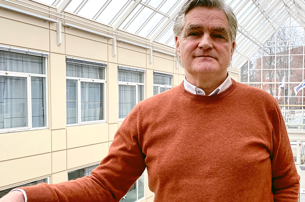
Publication profile
Publication profile
Rune Solberg
Name:
Rune Solberg
Title:
Forskningssjef BAMJO / Research Director BAMJO
Phone:
(+47) +47 22 85 26 92 Mob: +47 901 87 080
Email:
rune [at] nr [dot] no
Scientific areas:
Remote sensing, Climate monitoring, Geophysical variable retrieval, Retrieval of snow variables, Image analysis, Pattern recognition

Add to contacts (vCard) Show publications
Non-fiction book
2005
Remote Sensing of Snow Cover. In Remote Sensing in Northern Hydrology: Measuring Environmental Change. : 2005 pp 160.
. Academic article
2022
Estimating thin ice thickness around Svalbard using MODIS satellite imagery. Geografiska Annaler: Series A, Physical Geography (ISSN 0435-3676). 104(2) pp 127-149. doi: 10.1080/04353676.2022.2070158. 2022.
. 2019
Flood detection in Norway based on Sentinel-1 SAR imagery. International Archives of Photogrammetry, Remote Sensing and Spatial Information Sciences (ISSN 1682-1750). XLII-3/W8 pp 349-355. doi: 10.5194/isprs-archives-XLII-3-W8-349-2019. 2019. Omtale
. 2017
Remote sensing of snow wetness in Romania by Sentinel-1 and Terra MODIS data. Romanian Journal of Physics (ISSN 1221-146X). 62(821) 2017. Omtale Fulltekst
. 2016
Comparison and validation of four Arctic Sea ice thickness products of the EC POLAR ICE project. ESA SP (ISSN 0379-6566). SP-740 2016.
. Polar ice: Integrating, distributing and visualising ice information products for operators in polar waters. ESA SP (ISSN 0379-6566). SP-740 2016.
. 2015
User requirements for the snow and land ice services - CryoLand. The Cryosphere (ISSN 1994-0416). 9(3) pp 1191-1202. doi: 10.5194/tc-9-1191-2015. 2015.
. Introduction to GlobSnow Snow Extent products with considerations for accuracy assessment. Remote Sensing of Environment (ISSN 0034-4257). 156 pp 96-108. doi: 10.1016/j.rse.2014.09.018. 2015.
. 2014
Impact of satellite-based lake surface observations on the initial state of HIRLAM. Part I: Evaluation of remotelysensed lake surface water temperature observations. Tellus A: Dynamic Meteorology and Oceanography (ISSN 0280-6495). 66(1) doi: 10.3402/tellusa.v66.21534. 2014.
. 2010
. The development of new algorithms for remote sensing of snow conditions based on data from the catchment of vre Heimdalsvatn and the vicinity. Hydrobiologia (ISSN 0018-8158). 642(1) pp 35-46. doi: 10.1007/s10750-010-0157-3. 2010.
. A NEW GLOBAL SNOW EXTENT PRODUCT BASED ON ATSR-2 AND AATSR. IEEE Geoscience and Remote Sensing Letters (ISSN 1545-598X). pp 1780-1783. 2010. Fulltekst
. Investigating the Feasibility of the GlobSnow Snow Water Equivalent Data for Climate Research Purposes. Ukjent 2010. Fulltekst
.
. The development of new algorithms for remote sensing of snow conditions based on data from the catchment of Øvre Heimdalsvatn and the vicinity. Hydrobiologia (ISSN 0018-8158). 642 pp 35-46. 2010. Fulltekst
. 2009
Automatic Detection of Circular Structures in High-resolution Satellite Images of Agricultural Land. Archaeological Prospection (ISSN 1075-2196). 16(1) pp 1-15. doi: 10.1002/arp.339. 2009. Fulltekst
. Traffic Monitoring using Very High Resolution Satellite Imagery. Photogrammetric Engineering and Remote Sensing (ISSN 0099-1112). 75(7) pp 859-869. 2009. Fulltekst
. 2008
. Evaluation of satellite images of snow cover areas for improving spring flood in the HBV model. Ukjent 2008. Fulltekst
. 2007
Proceedings of the 9th International Symposium on High Mountain Remote Sensing Cartography. Ukjent 43 pp 109-112. 2007.
. 2006
. 2005
A model-based approach for geometrical correction of optical satellite images. International Journal of Remote Sensing (ISSN 0143-1161). 26 2005.
. Multi-sensor/multi-temporal approaches for snow cover area monitoring. Ukjent 2005.
. Multi-sensor monitoring of snow parameters in Nordic mountainous areas. Ukjent 2005.
.
. 2004
Reflectance modeling of snow-covered forests in hilly terrain. Photogrammetric Engineering and Remote Sensing (ISSN 0099-1112). 70(9) pp 1069-1079. 2004.
.
.
. 2003
Subpixel mapping of snow cover in forests by optical remote sensing. Remote Sensing of Environment (ISSN 0034-4257). 84(1) pp 69-82. 2003.
. Improving runoff simulations using satellite-observed time-series of snow covered area. Nordic Hydrology (ISSN 0029-1277). 34(4) pp 281-294. 2003.
. A system for cryospheric observations and climate modelling in Europe. Geophysical Research Abstracts (ISSN 1029-7006). 5 pp 3258. 2003. Fulltekst
. Snow-cover mapping in forest by constrained linear spectral unmixing of MODIS data. Remote Sensing of Environment (ISSN 0034-4257). 2003. Fulltekst
. A constrained spectral unmixing approach to snow-cover mapping in forest using MODIS data. Ukjent 2003. Fulltekst
. Subpixel mapping of snow cover in forest by optical remote sensing. Remote Sensing of Environment (ISSN 0034-4257). 2003.
. A comparison of temperature retrieval algorithms for snow covered surfaces. Ukjent 2003.
. 2002
Technological concepts for modelling, monitoring and mapping the terrestrail cryosphere on continental to global scale. Norsk Geografisk Tidsskrift (ISSN 0029-1951). 56 pp 174-178. doi: 10.1080/002919502760056503. 2002.
. Satellite monitoring of the cryosphere for enhanced climate change modelling: The EuroClim project. Ukjent 2002.
.
. An advanced forest environmental monitoring and management system: conceptual overview of the FOREMMS prototype. Ukjent 2002 2002.
. Techn. concepts for modelling, monitoring and mapping the terrestrial cryosphere on the continental to global scale. Ukjent 2002.
.
. Euroclima system for enhanced modelling of climate change in Europe by the use of satellite monitoring of the cryosphere. Ukjent 2002. Fulltekst
.
. 2000
A method for snow-cover mapping in forest by optical remote sensing. Ukjent 2000.
. Empirical anisotropic spectral reflectance model for snow derived from DAIS-7915 airborne spectrometer data. Ukjent 2000.
. 1999
Automatic detection of oil spills in ERS SAR images. IEEE Transactions on Geoscience and Remote Sensing (ISSN 0196-2892). 37(4) pp 1916-1924. doi: 10.1109/36.774704. 1999.
. A model-based approach for geometrical correction correction of optical satellite images. Ukjent pp 330-332. 1999.
. 1998
Wet snow-cover mapping by C- and L-band polarimtric SAR. Ukjent 1998.
.
. Research and development of remote sensing methods for snow hydrology. Ukjent pp 643-648. 1998. Fulltekst
. SNOWTOOLS: Research and development of methods supporting new snow products. Ukjent pp 649-658. 1998. Fulltekst
. 1997
Semi-automatic revision of forest maps combining spectral, textural, laser altimeter and GIS data. Ukjent 1997.
. EMISAR and ERS-1 data within the European Multi-sensor Airborne Campaign EMAC-95. Ukjent pp 111-119. 1997. Fulltekst
. Snow monitoring using EMISAR and ERS-1 data within the European Multi-sensor Airborne Campaign EMAC-95. Ukjent pp 631-633. 1997. Fulltekst
. 1996
Radar satellites: A new tool for pollution monitoring in coastal waters. Coastal Management (ISSN 0892-0753). 24 pp 61-71. doi: 10.1080/08920759609362281. 1996.
. ENVISYS - A remote sensing system for detection of oil spills in the Mediterranean. Presented at the 16th EARSeL Symposium, Integrated Applications for Risk Assessment and Disaster Prevention for the Mediterranean, Malta, 20-23 May 1996. Ukjent 1996. Fulltekst
. A large-scale evaluation of features for automatic detection of oil spills in ERS SAR images. Ukjent 1996.
. Prediction of petrophysical parameters based on digital core images. Ukjent 1996.
. Integrasjon av satellittbasert snøkartlegging og HBV-modellen. Ukjent 1996.
. The suitability of future high-resolution satellite imagery for forest inventory. Ukjent 1996.
. Semi-automatic revision of forest maps combining spectral, textural, laser altimeter and GIS data. Ukjent 1996.
.
. Monitoring soil erosion using land cover and tillage derived from satellite imagery. Ukjent 1996. Fulltekst
. 1995
Using remote sensing for monitoring of autumn tillage in Norway. International Journal of Remote Sensing (ISSN 0143-1161). 16(3) pp 447-466. 1995.
. 1994
An automatic system for operational snow-cover monitoring in the Norwegian mountain regions. Ukjent 1994.
. 1993
Automatic feature selection in hyperspectral satellite imagery. Ukjent 1993.
. Detection of oil spill in SAR images using a statistical classification scheme. Ukjent 1993.
. Operational monitoring of snow coverage and soil erosion in Norway. Ukjent pp 12. 1993.
. Mapping of snow cover by ERS-1 SAR. Ukjent 1993.
. 1992
A system for monitoring ice in polar regions by SAR. Ukjent 1992.
. Registration of the use of agricultural fields and soil erosion using satellite remote sensing. Ukjent 1992.
. Monitoring soil erosion in agricultural fields by ERS-1 SAR. Ukjent 1992.
. Semi-automatic revision of topographic maps from satellite imagery. Ukjent 1992.
. Monitoring soil erosion in agricultural fields to reduce pollution in the North sea. Ukjent 1992.
. 1991
Interpretation of aerial images of high resolution. Ukjent 1 pp 309-312. 1991.
. 1990
Semi-automatic revision of topographic maps. Ukjent 1990.
. Detection of urban areas by interference filtering. Ukjent III pp 1995-1998. 1990.
. 1988
Satellite imagery for semi-automatic map revision. Ukjent 1988.
. Automatisk tolkning av satellittbilder for kartrevisjon. Ukjent 1988.
. Academic chapter/article/Conference paper
2013
Semi-automatic detection of rainfall-triggered landslides in segmented optical satellite images. In: Proceeding of The Joint Urban Remote Sensing Event (JURSE) 2013. (ISBN 978-1-4799-0213-2). pp 254-257. doi: 10.1109/JURSE#.2013.6550713. 2013.
. 2010
A new global Snow Extent product based on ATSR-2 and AATSR. In: Geoscience and Remote Sensing Symposium (IGARSS), 2010 IEEE International. (ISBN 978-1-4244-9566-5). pp 1780-1783. doi: 10.1109/IGARSS.2010.5649330. 2010. Fulltekst
. DUE avalRS: Remote-Sensing Derived Avalanche Inventory Data for Decision Support and Hind-Cast after Avalanche Events. In: Proceedings of the ESA Living Planet Symposium. (ISBN 978-92-9221-250-6). 2010. Fulltekst
. Retrieving black carbon on snow and ice surfaces in the arctic. In: Proceedings of ESA Living Planet Symposium SP-686. (ISBN 9789292212506). 2010. Fulltekst
. A new global snow extent product. In: Proceedings of the ESA Living Planet Symposium. (ISBN 978-92-9221-250-6). 2010. Fulltekst
. 2006
An approach for multisensor harmonization in snow cover area mapping. In: Geoscience and Remote Sensing Symposium, 2006. IGARSS 2006. IEEE International Conference on. (ISBN 0-7803-9510-7). pp 2171-2175. doi: 10.1109/IGARSS.2006.561. 2006. Fulltekst
. 2005
Monitoring forest health by remote sensing of canopy chlorophyll: first results from a pilot project in Norway. In: Proceedings, CD-ROM. 2005. Fulltekst
. Alignment of growth seasons from satellite data. In: Proceedings of the 2005 International Workshop on the Analysis of Multi-Temporal Remote Sensing Images, Biloxi, Mississippi, USA, 16-18 May 2005. (ISBN 0-7803-9118-7). pp 213-216. doi: 10.1109/AMTRSI.2005.1469875. 2005. Fulltekst
. Use of hidden Markov models and phenology for multitemporal satellite image classification: applications to mountain vegetation classification. In: Proceedings of the 2005 International Workshop on the Analysis of Multi-Temporal Remote Sensing Images, Biloxi, Mississippi, USA, 16-18 May 2005. (ISBN 0-7803-9118-7). pp 220-224. doi: 10.1109/AMTRSI.2005.1469877. 2005. Fulltekst
. Model-driven retrieval of fractional snow cover area. In: Proceedings of the 2005 IEEE International Geoscience and Remote Sensing Symposium, IGARSS '05. (ISBN 0-7803-9050-4). pp 1943-1946. doi: 10.1109/IGARSS.2005.1526391. 2005. Fulltekst
. 2004
A high-precision dynamic and adaptive BRDF and fractional snow-cover monitoring algorithm. In: Geoscience and Remote Sensing Symposium, 2004. IGARSS '04. Proceedings. 2004 IEEE International. (ISBN 0-7803-8742-2). pp 3721-3724. doi: 10.1109/IGARSS.2004.1369930. 2004. Fulltekst
. Multi-sensor and time-series approaches for monitoring of snow parameters. In: Geoscience and Remote Sensing Symposium, 2004. IGARSS '04. Proceedings. 2004 IEEE International. (ISBN 0-7803-8742-2). pp 1661-1666. doi: 10.1109/IGARSS.2004.1370649. 2004. Fulltekst
. Academic lecture
2022
A new 38-year time series of daily, global fractional snow cover maps. 16th International Circumpolar Remote Sensing Symposium; Fairbanks, 5/16/2022 - 5/20/2022.
. 2021
A new climate snow cover record based on ATSR-2 and AATSR. EUMETSAT 2021 Conference, 9/20/2021 - 9/24/2021.
. Development of a new 38-year time series of daily, global fractional snow cover products based on fusion of optical and passive microwave radiometer data. From Science to Operations for Copernicus Imaging Microwave Radiometer (CIMR) Mission, 5/11/2021 - 5/12/2021.
. 2020
SEN4POL – Towards a Sentinel-based pollen information service. Faggruppe satellittdata workshop; Online, 9/7/2020.
. Remote Sensing of Snow Properties with Sentinel-3 versus MODIS. 9th EARSeL workshop on Land Ice and Snow; Bern, 2/3/2020 - 2/5/2020.
. Utvikling av operasjonell Snøtjeneste og Innsjøistjeneste hos NVE. Ny Copernicus-periode, Infodag; webinar, 10/22/2020 - 10/22/2020 1:00:00 AM.
. SEN4POL – Towards a Sentinel-based pollen information service. Copernicus Day of the Norwegian Space Agency; Online, 10/22/2020 - 10/22/2020 1:00:00 AM.
. 2019
Landslide detection and mapping by remote sensing. International Symposium on Mitigative Measures against Snow Avalanches and Other Rapid Gravity Mass Flows, 3-5 April 2019,; Siglufjörður, 4/3/2019 - 4/5/2019.
. Remote sensing of snow properties with Sentinel-3. Nordic Remote Sensing Conference; Århus, 9/17/2019 - 9/19/2019.
. Monitoring lake ice cover with Sentinel-3. ESA Living Planet Symposium; Milano, 5/13/2019 - 5/17/2019.
. 2018
Local and regional trends in snow cover from a 34-year time series of satellite observations. 15th International Circumpolar Remote Sensing Symposium (ICRSS); Potsdam, 9/10/2018 - 9/14/2018.
. A portfolio of snow products based on Sentinel-3 for snow hydrology. SnowHydro – International Conference on Snow Hydrology; Heidelberg, 2/12/2018 - 2/15/2018.
. 2017
Local and regional trends in snow cover from a 34-year time series of satellite observations. IGS International Symposium on Polar Ice, Polar Climate, Polar Change; Boulder, CO, 8/14/2017 - 8/19/2017.
. Remote sensing of snow wetness using Sentinel: a multisensor approach. IGS International Symposium on Polar Ice, Polar Climate, Polar Change; Boulder, CO, 8/14/2017 - 8/19/2017.
. Multi-sensor wet snow product (MWS) from Sentinel-1 and Sentinel-3 vs multi-sensor wet snow product (MWS) from Sentinel-1 and MODIS. 19th International Symposium on Symbolic and Numeric Algorithms for Scientific Computing; Timisoara, 9/21/2017 - 9/24/2017.
. Towards a portfolio of products for snow surface characterisation based on Sentinel-3. Workshop on Modeling Meltwater in Snow and Firn: Processes, Validation, Intercomparison and Model Uses of Optical Remotely Sensed Data; Copenhagen, 9/20/2017 - 9/22/2017.
. Optical remote sensing of snow. Workshop on X-ray micro-tomography of porous ice media; Trondheim, 6/22/2017 - 6/23/2017.
. Developing an approach for satellite observations of black carbon in snow surfaces in the Arctic. International Conference on High Latitude Dust 2017; Reykjavik, 5/20/2017 - 5/25/2017.
. A multi-sensor multi-temporal approach to retrieving snow surface wetness from a combination of Sentinel-1 and Sentinel-3 data. 8th EARSeL workshop on Land Ice and Snow; Bern, 2/7/2017 - 2/9/2017.
. 2016
Preparing for a national service for flood monitoring using Sentinel-1. ESA Living Planet Symposium, 5/9/2016.
. Cryospheric albedo from Sentinel-3 and -2. ESA Living Planet Symposium; Prague, 5/9/2016 - 5/13/2016.
. Single and multi-sensor snow wetness mapping by Sentinel-1 and Sentinel-3 data. The 18th International Symposium on Symbolic and Numerical Algorithms for Scientific Computing, Geoinformatics Workshop; Timisoara, 9/24/2016 - 9/27/2016.
. Single- and multi-sensor snow wetness mapping by Sentinel-1 and MODIS data. 73rd Eastern Snow Conference; Columbus, Ohio, 6/14/2016 - 6/16/2016.
. 2015
Advancements and validation of the global CryoClim snow cover extent product. 2nd International Satellite Snow Products Intercomparison (ISSPI) Workshop; Boulder, Colorado, 9/14/2015 - 9/16/2015.
. Advancements and validation of a global snow product fusing optical and passive microwave radiometer data. 2015 EUMETSAT Meteorological Satellite Conference,; Toulouse, 9/21/2015 - 9/25/2015.
. Monitoring of snow properties with Sentinel-3. ESA Sentinel-3 for Science Workshop; Venezia, 6/2/2015 - 6/5/2015.
. Global snow cover mapping using a multi-temporal multi-sensor approach. 8th International Workshop on the Analysis of Multitemporal Remote Sensing Images; Annecy, 7/22/2015 - 7/24/2015.
. 2014
A new global snow cover product based on multi-sensor multi-temporal satellite data. 1st Satellite Snow Product Intercomparison and Evaluation Experiment Workshop; Maryland, 7/21/2014 - 7/23/2014.
. Impact on runoff simulation by assimilation of remote sensing snow data in a multi-basin hydrological model for Sweden. European Geosciences Union (EGU) General Assembly 2014; Vienna, 4/27/2014 - 5/2/2014.
. The Satellite Snow Product Intercomparison and Evaluation Experiment – SNOWPEX. 1st International Arctic Products Validation & Evolution (APVE) Workshop; Ottawa, 11/12/2014 - 11/13/2014.
. A multi-parameter multi-temporal algorithm for inference of snow wetness from optical satellite data. Workshop: Liquid water in snow - Measurement techniques and modeling approaches; Davos, 4/2/2014 - 4/4/2014.
. A new multi-sensor multi-temporal global snow cover product based on satellite data. Climate Symposium 2014; Darmstadt, 10/13/2014 - 10/17/2014.
. The advancements of Northern Hemisphere GlobSnow-2 SWE and SE products. 7th EARSeL Workshop on Land Ice and Snow; Bern, 2/3/2014 - 2/6/2014.
. Preparation of European snow, glacier and lake/river ice services within the Copernicus CryoLand project. 7th EARSeL Workshop on Land Ice and Snow; Bern, 2/3/2014 - 2/6/2014.
. Evaluation and Quality assessment of GlobSnow-2 version 2 products. 7th EARSeL Workshop on Land Ice and Snow; Bern, 2/3/2014 - 2/6/2014.
. Multi-sensor fusion of Radarsat-2 and MODIS data for snow cover mapping in Norway. International Geoscience and Remote Sensing Symposium; Québec, 7/13/2014 - 7/18/2014.
. A multi-sensor multi-temporal algorithm for snow cover extent retrieval from optical and passive microwave data. 7th EARSeL Workshop on Land Ice and Snow; Bern, 2/3/2014 - 2/6/2014.
. 2013
CryoClim: A new operational system and service for climate monitoring of the cryosphere. EUMETSAT Meteorological Satellite Conference & 19th American Meteorological Society (AMS) Satellite Meteorology; Vienna, 9/16/2013 - 9/20/2013.
. CryoClim: A new system and service for climate monitoring of the cryosphere. 35th International Symposium on Remote Sensing of Environment; Beijing, 4/22/2013 - 4/26/2013.
. Automatic avalanche mapping using texture classification of optical satellite imagery. 33rd EARSeL Symposium; Matera, 6/3/2013 - 6/6/2013.
. High resolving sea ice concentration, and thickness of thin sea ice. Joint PI Workshop of Global Environment Observation Mission 2012; Tokyo, 1/29/2013 - 2/1/2013.
. 2012
Remote-Sensing Derived Avalanche Inventory Data. International Snow Science Workshop; Anchorage, Alaska USA, 9/17/2012 - 9/21/2012. Fulltekst
. Automatic estimation of lake ice cover and lake surface temperature using ENVISAT MERIS and AATSR. EGU Assembly; Wien, 4/23/2012 - 4/27/2012.
. Simultaneous Envisat ASAR and MERIS monitoring of lake ice on Lake Ladoga. EGU Assembly; Wien, 4/23/2012 - 4/27/2012.
. Experiments with remote sensing in the context of avalanche warning and detection. Advances in Avalanche Forecasting; Podbanské, 10/22/2012.
. Automatic estimation of seasonal sea ice thickness with MODIS data. IGS International symposium of seasonal snow and ice; Lahti, 5/28/2012 - 6/1/2012.
. 2011
Bayesian model for snow retrieval from SSM/I data. Nordic Remote Sensing Days; Tromsø, 8/30/2011 - 8/31/2011.
. The CryoClim system for cryospheric climate monitoring. Nordic Remote Sensing Days, 8/30/2011 - 8/31/2011. Fulltekst
. First snow cover extent time series based on 15 years of observations with ERS-2 ATSR-2 and Envisat AATSR. 6th EARSeL Workshop on Land Ice and Snow, 7-9 February 2011, Berne, Switzerland; Berne, 2/7/2011 - 2/9/2011. Fulltekst
. Automatic detection of avalanches in high resolution optical satellite data. Nordic Remote Sensing Days; Tromsø, 8/30/2011 - 8/31/2011.
. 2010
Remote sensing of black carbon at snow and glacier ice surfaces - first results of a modelling approach. International workshop on Black Carbon in snow - sampling, albedo effects and climate impact, 13-14, 2/1/2010. Fulltekst
.
. Development of Long Term Snow Water Equivalent Information for Climate Research Purposes in ESA GlobSnow Project. International Polar Year Oslo Science Conference, 8–12 June 2010, Oslo, Norway, 6/1/2010.
. 2009
Traffic monitoring from space for sustainable development of the road network. ISRSE'33 International Symposium on Remote Sensing of Environment, 5/4/2009 - 5/8/2009.
. Remote Sensing of Black Carbon in the Arctic. 33rd International Symposium on Remote Sensing of Environment (ISRSE-33), 4-8 May 2009, Stresa, Ital, 5/4/2009. Fulltekst
. Aerosol deposition on glaciers and resulting melting from darkening. International Scientific Congress on Climate Change. 10-12 March 2009, Copenhagen, Denmark, 3/11/2009.
. Could retrieval of snow layer formation by optical satellite remote sensing help avalanche forecasting? Presentation of first results. International Snow Science Workshop (ISSW 2010), 27 September – 2 October 2009, Davos, Switzerland, 10/2/2009. Fulltekst
. Land cover classification of cloud- and snow-contaminated multi-temporal high-resolutionsatellite images. 3rd Workshop of the EARSeL SiG Remote Sensing of Land Use and Land Cover, 25 - 27 November 2009, Bon, 11/24/2009. Fulltekst
. 2008
Time series fusion of optical and SAR data for snow cover estimation using a hidden Markov model. NOBIM-konferansen 2008 i Trondheim, 6/5/2008. Fulltekst
. Detection of ring shaped structures in agricultural land using high resolution satellite images. GEOBIA, 2008 - Pixels, Objects, Intelligence: GEOgraphic Object Based Image Analysis for the 21st Century, 8/5/2008 - 8/8/2008. Fulltekst
. Mapping Road Traffic Conditions Using High Resolution Satellite Images. GEOBIA, 2008 - Pixels, Objects, Intelligence: GEOgraphic Object Based Image Analysis for the 21st Century, 8/5/2008 - 8/8/2008. Fulltekst
. Deteksjon av ringformede fotgrøfter i høyoppløselige satellittbilder av jordbruksområder. CAA Norge konferansen 2008, 10/21/2008. Fulltekst
. Detection of burial mounds in high-resolution satellite images of agricultural land. 1st International EARSeL Workshop on Advances in Remote Sensing for Archaeology and Cultural Heritag, 9/30/2008. Fulltekst
. Ring grave detection in high resolution satellite images of agricultural land. NOBIM-konferansen 2008 i Trondheim, 6/5/2008. Fulltekst
. Satellittfjernmåling av snødekning og snøens egenskaper. Seminar om fjernmålingsbasert kartlegging for overvåking av reinbeiter og fjellvegetasjon, Norsk vil, 4/3/2008.
. EuroCryoClim project and envisioned services. Commission of Earth Observation Satellites (CEOS), WGISS-25, 25-29 February 2008, Sanya, China, 2/28/2008.
. 2007
A new approach fusing optical and SAR data for snow cover area mapping. International Symposium on Snow Science, Moscow, Russia, 3-7 September 2007, 9/5/2007.
. Mapping and Modelling the Snowmelt and Greening Pattern in Southern Norway by Combining Microwave and Optical Remote Sensing Sensors. International Geoscience and Remote Sensing Syposium (IGARSS), Barcelona, Spain, 23-27 July 2007, 7/23/2007. Fulltekst
. 2005
Remote sensing of foliar mass and chlorophyll as indicators of forest health: preliminary results from a project in Norway. ForestSat 2005; Borås, Sweden, 5/31/2005 - 6/3/2005. Fulltekst
. Satellite based snow monitoring for hydropower production and trade in Norway - – results versus operational needs. 31st International Symposium on Remote Sensing of Environment (31 ISRSE). Proceedings. St. Petersbur, 6/1/2005. Fulltekst
. 2004
Algorithms for oil spill detection in Radarsat and ENVISAT SAR images. IEEE International Geoscience and Remote Sensing Symposium; Anchorage, Alaska, 9/20/2004 - 9/24/2004.
. Evaluation of algorithms for the retrieval of snow grain size from optical satellite data. The 8th Circumpolar Symposium on Remote Sensing of Polar Environments, Chamonix, France, 6/8/2004.
. A new solution to improved climate change observations and modelling. Enviroinfo 2004, Geneva, Switzerland, 10/21/2004. Fulltekst
. Satellite based near real-time multi-temporal and multi-sensor retrieval of snow parameters in mountainus areas. Geophysical Research Abstracts, Vol. 6, 06146, 2004 and European Geosciences Union Meeting, Nice, Fr, 1/1/2004. Fulltekst
. Evaluation of algorithms for the retrieval of snow surface temperature from medium resolution satellite data. The 8th Circumpolar Symposium on Remote Sensing of Polar Environments, Chamonix, France, 6/8/2004.
. 2003
A Constrained Spectral Unmixing Approach to Snow- Cover Mapping in Forests using MODIS Data. IGARSS 2003; Toulouse, 7/20/2003 - 7/25/2003.
. Multisensor remote sensing of snow cover. International Union of Geophysics and Geodesy (IUGG), 6/30/2003. Fulltekst
. 2002
FOREMMS – a system prototype for large scale environmental forest monitoring. ForestSAT Symposium, Heriot Watt University, Edinburgh, August 5th-9th of August 2002, 8/6/2002. Fulltekst
. Norwegian Computing Center. Workshop on Sino-Norwegian ICT cooperation, Prime Minister visit to China, 19-13 January 2002, 1/19/2002.
. 2001
The Forest Environmental Monitoring and Management System (FOREMMS). Final Workshop on the EU project Transnational Network on Environmental Laboratories, Florence, Ital, 9/14/2001.
. Investigation of the snow-cover mapping accuracy using MODIS. 4th international symposium on remote sensing in glaciology, 4-8 June 2001, College Park, Maryland, 6/1/2001.
. The Forest Environmental Monitoring and Management System (FOREMMS) project. International Workshop Geospatial Knowledge Processing for Natural Resource Management, Varese, 6/28/2001. Fulltekst
. FOREMMS and EuroClim projects. Global Monitoring for Environment & Security: Towards Implementation, Brussels, Belgium, 10/14/2001.
. Forest Environmental Monitoring and Management System CEC FP5 IST Project. Fifth EUROLAT-IS Thematic Workshop, IST for the Environment and Tourism, Quito, Ecuador, 7/9/2001.
. 2000
A Method for Optical Snow-Cover Mapping in Sparse Forest. IGARSS-International Geoscience and Remote Sensing Symposium; Hawaii, USA, 7/1/2000. Fulltekst
. A new method for sub-pixel snow-cover mapping using hyperspectral imagery. NOBIM-konferansen, 6/6/2000. Fulltekst
. 1998
SNOWTOOLS - Research and development of remote sensing methods for snow hydrology. 27th international symposium on remote sensing of environment. Abstract. Tromsø, Norway, 6/8/1998.
. SNOWTOOLS - An European project for research and development of remote sensing methods for snow hydrology. International conference on snow hydrology. Abstracts. Brownsville, Vermont, USA, 10/6/1998. Fulltekst
. Telematics for monitoring environmental emergencies. European telematics: Advancing the information society. Proceedings. Barcelona, 2/4/1998. Fulltekst
. SNOWTOOLS. Norges forskningsråd/EnFOs FoU-dager. Bergen, 11/24/1998.
. 1996
Automatisk geometrisk oppretting av NOAA AVHRR bilder for snøkartlegging. Fotogrammetridagene, Lørenskog, 10/17/1996. Fulltekst
. 1995
Integrasjon av satellittbasert snøkartlegging og HBV-modellen. GIS i vassdrag, NTH, Trondheim, 10/26/1995.
. 1993
Utfordringer i satellittfjernmåling til neste generasjon GIS. Neste generasjon GIS. NLH, ÅS, 12/16/1993.
. 1992
Monitoring soil erosion in agricultural fields by optical satellite imagery. International Geoscience and Remote Sensing Symposium; Huston, 5/24/1992 - 5/27/1992.
. Satellittfjernmåling - teori og praksis. Brukersamling for Terra Soft. Biri, 5/5/1992.
. Analyse av SAR-bilder for jorderosjonsovervåkning. Seminar, Institutt for Informatikk, Universitetet i Oslo, 4/6/1992.
. 1989
AUTOSAT - et samarbeidsprosjekt mellom Statens kartverk og Norsk Regnesentral for ajourføring av topografiske kart. Norges Landbrukshøgskoles kurs i Satellittkartlegging, Sem i Asker, 10/9/1989.
. 1987
Ikke til å kjenne igjen. Innlegg og demonstrasjon av hva vår avanserte bildebehandlingsmaskin kan gjøre med et bilde. NR's Pr, 11/19/1987.
. Abstract
2012
Simultaneous Envisat ASAR and MERIS monitoring of lake ice on Lake Ladoga. Geophysical Research Abstracts. 14 2012.
. Automatic estimation of lake ice cover and lake surface temperature using ENVISAT MERIS and AATSR. Geophysical Research Abstracts. 14(1) pp 5306. 2012. Fulltekst
. Lecture
2022
Potensialet i data. NFR og KLD frokostmøte: Data og datadeling, 9/29/2022.
. 2020
Flomtjenesten. Ny Copernicus-periode, Infodag; Oslo, 10/22/2020.
. 2018
Snow products and services under development by the Norwegian Computing Center. Copernicus Snow and Ice Monitoring Workshop; Købehavn, 1/24/2018 - 1/25/2018.
. 2016
Current achievements towards developing downstream services for snow monitoring in Romania. 5th COPERNICUS Conference for the Eastern European Copernicus users and service providers; Bucuresti, 10/5/2016 - 10/6/2016.
. Algorithms for monitoring of snow, sea ice and glaciers – the CryoClim project. ESA PRODEX 30 Year Anniversary Workshop; Noordwijk, 9/5/2016 - 9/6/2016.
. Status and further development of CryoClim global Snow Cover Extent product. WMO GCW 2nd Snow Watch Team Meeting; Columbus, Ohio, 6/13/2016 - 6/14/2016.
. Bedre prognoser ved bruk av satellittdata i kombinasjon med data fra andre kilder. FlomQ – Workshop om flomestimering; Trondheim, 5/23/2016 - 5/25/2016.
. Poster
2019
Monitoring Thin Sea Ice Thickness with Sentinel-3. IGS International Symposium on Sea Ice at the Interface; Winnipeg, 8/19/2019 - 8/23/2019.
. Mapping snow surface hoar by optical remote sensing. International Symposium on Mitigative Measures against Snow Avalanches and Other Rapid Gravity Mass Flows; Siglufjörður, 4/3/2019 - 4/5/2019.
. 2018
Local and regional trends in snow cover from a 34-year time series of satellite observations. 2018 EUMETSAT Meteorological Satellite Conference; Tallinn, 9/17/2018 - 9/21/2018.
. 2016
Single and multi-sensor snow wetness mapping by Sentinel-1 and Sentinel-3 data. ESA Living Planet Symposium; Prague, 5/9/2016 - 5/13/2016.
. Multi-sensor fractional snow cover mapping by fusion of Sentinel-1 and Sentinel-3 data. ESA Living Planet Symposium; Prague, 5/9/2016 - 5/13/2016.
. 2014
Unsupervised change detection in large-size images: exploring edges in multi-temporal remote sensing acquisitions. 5th Geographic Object-Based Image Analysis Conference (GEOBIA); Thessaloniki, 5/21/2014 - 5/24/2014.
. 2013
CryoClim: A new operational system and service for climate monitoring of the cryosphere. ESA Living Planet Symposium; Edinburgh, 9/9/2013 - 9/13/2013.
. 2010
Producing Snow Extent and Snow Water Equivalent Information for Climate Research Purposes – ESA DUE GlobSnow Effort. European Geosciences Union General Assembly 2010, 2–7 May 2010, Vienna, Austria, 5/7/2010.
. The New Global Snow Extent Product Developed by the GlobSnow Project. Workshop on Cold Regions Hydrology, 28–30 April 2010 Innsbruck, Austria, 5/1/2010.
. New Global Snow Extent Product Based on Optical Satellite Data. , .
. Organic and black carbon deposition on melting glaciers. International Polar Year Oslo Science Conference, 8–12 June 2010, Oslo, Norway, 6/1/2010.
. 2007
Methods for the detection of long term spectral changes in natural vegetation. An example from Norwegian mountain vegetaion. EARSel Workshops in the 27th EARSeL Symposium, 7-8 June 2007, Bozen/Bolzano, Italy, 6/7/2007.
. 2006
Snow and Vegetation Monitoring in the Scandinavian Mountains. 9th International Symposium on High Mountain Remote Sensing Cartography, Graz, Austria, 14-15 Sept 2, 9/15/2006.
. A New System and Service for Climate Monitoring in the Cryosphere. International Symposium on Cryospheric Indicators of Global Climate Change, Cambridge, England, 21–2, 8/21/2006. Fulltekst
. 2005
EuroClim: A New System for Climate Change Monitoring of the Euro-Arctic Region. Climate and Cryosphere (CliC) First Science Conference, Beijing, China, 11-15 April 2005, 4/11/2005.
. 2003
Automatic detection of oil spills in ENVISAT, Radarsat and ERS SAR images. IGARSS03; Toulouse, 7/21/2003 - 7/25/2003. Fulltekst
. 2001
Snow-cover mapping in forest. - The influence of the topography. 4th International Symposium on Remote Sensing in Glaciology; College Park, Maryland, U.S.A, 6/8/2001.
. Report
2022
WetSnow processing chain. WetSnow project report no. 1. Norsk Regnesentral. NR-notat SAMBA/06/22. pp 34. 2022.
. Sentinel for snow surface hoar mapping. Sentinel4SurfaceHoar project results. Norsk Regnesentral. NR-notat SAMBA/04/22. pp 72. 2022.
. 2021
Utvikling av operasjonell snøtjeneste ved NVE. Resultater fra prosjektfase 3. Norsk Regnesentral. NR-notat SAMBA/37/21. pp 62. 2021.
. Snow Product User Guide. AI4Arctic guide to snow products V1. Norsk Regnesentral. NR-notat SAMBA/15/21. pp 26. 2021.
. Final report. AI4Arctic Deliverable 6. Norsk Regnesentral. NR-notat SAMBA/19/21. pp 78. 2021.
. Automatisk skydeteksjon i Sentinel-3 SLSTR satellittbilder med U-Net. Første resultater. Norsk Regnesentral. NR-notat SAMBA/26/21. pp 146. 2021.
. 2020
Design and development toward a global flood monitoring product. GlobFlom report. Norsk Regnesentral. NR-notat SAMBA/49/20. pp 68. 2020.
. Mid-term report. AI4Arctic Deliverable 5. Norsk Regnesentral. NR-notat SAMBA/39/20. pp 38. 2020.
. Dataset and data policy. AI4Arctic Deliverable 3. Norsk Regnesentral. NR-notat SAMBA/32/20. pp 44. 2020.
. Multi-sensor multi-temporal FSC 2017-2020 dataset. S4S multi-FSC prototype products to EDI, Version 2.0. Norsk Regnesentral. NR-notat SAMBA/24/20. pp 30. 2020.
. Problem statement and methodologies. AI4Arctic Deliverable 1. Norsk Regnesentral. NR-notat SAMBA/18/20. pp 46. 2020.
. Project management plan. AI4Arctic Deliverable 0. Norsk Regnesentral. NR-notat SAMBA/14/2020. pp 20. 2020.
. ICT requirements and API. AI4Arctic Deliverable 2. Norsk Regnesentral. NR-notat SAMBA/20/20. pp 24. 2020.
. Software package: AI4Arctic Deliverable 4. Norsk Regnesentral. NR-notat SAMBA/47/20. pp 26. 2020.
. Sentinel4ThinIce Phase 2 WP8: Diagnosis and correction of possible underestimated ice thickness. Sentinel4ThinIce project report 2020. Norsk Regnesentral. NR-notat SAMBA/15/20. pp 24. 2020.
. 2019
Utvikling av operasjonell snøtjeneste ved NVE. Resultater fra prosjektfase 2. Norsk Regnesentral. NR-notat SAMBA/52/2019. pp 50. 2019.
. Utvikling av operasjonell flomtjeneste ved NVE. Resultater fra prosjektfase 3. Norsk Regnesentral. NR-notat SAMBA/09/2019. pp 42. 2019.
. System for deteksjon og kartlegging av flom basert på SAR. Norsk Regnesentral. NR-notat SAMBA/11/19. pp 20. 2019.
. ESA CCI+ Snow ECV: End-to-End ECV Uncertainty Budget, verson 1.0. European Space Agency. pp 26. 2019.
. Algorithms for flood detection and mapping by SAR. Algorithm Theoretical Basis Document, Flood Service System at NVE. Norsk Regnesentral. NR-notat SAMBA/10/19. pp 24. 2019.
. Utvikling av operasjonell innsjøistjeneste hos NVE: Resultater fra prosjektfase 2. Norsk Regnesentral. NR-notat SAMBA/45/19. pp 56. 2019.
. Sentinel4ThinIce Phase 2. Thin ice thickness retrieval with Sentinel-3. Norsk Regnesentral. NR-notat SAMBA/53/19. pp 27. 2019.
. SEN4POL Phase-1: Final Scientific Report. Norsk institutt for luftforskning. pp 40. 2019.
. 2018
Utvikling av operasjonell snøtjeneste hos NVE. Resultater fra prosjektfase 1. Norsk Regnesentral. NR-notat SAMBA/19/18. pp 46. 2018.
. Further advancement of global snow mapping in CryoClim. Sentinel4CryoClim Phase 2 - Deliverables 1, 3-7. Norsk Regnesentral. NR-notat SAMBA/44/18. pp 82. 2018.
. Single- and multi-sensor snow-cover mapping from Sentinel-3 and Sentinel-1. Norsk Regnesentral. NR-notat SAMBA/43/18. pp 60. 2018.
. Utvikling av operasjonell innsjøistjeneste hos NVE. Resultater fra prosjektfase 1. Norsk Regnesentral. NR-notat SAMBA/20/18. pp 37. 2018.
. 2017
Utvikling av operasjonell flomtjeneste ved NVE. Resultater fra prosjektfase nr. 1. Norsk Regnesentral. NR-notat SAMBA/07/2017. pp 34. 2017.
. Utvikling av operasjonell flomtjeneste ved NVE, Resultater fra prosjektfase 2. Norsk Regnesentral. NR-notat SAMBA/37/2017. pp 28. 2017.
. Multi-sensor/multi-temporal prototype wet snow product – Version 3, SnowBall WP3, Deliverable D3.4, Sentinel-3 extension. Norsk Regnesentral. NR-notat SAMBA/16/2017. pp 112. 2017.
. Multi-sensor/multi-temporal prototype wet snow product – Version 2, SnowBall WP3, Deliverable D3.4. Norsk Regnesentral. NR-notat SAMBA/15/2017. pp 34. 2017.
. Advancement of global snow mapping in CryoClim, Sentinel4CryoClim Phase 1, Deliverables 1-6. Norsk Regnesentral. NR-notat SAMBA/10/2017. pp 80. 2017.
. Sentinel4ThinIce Phase 1: Algorithm improvements, validation and intercomparison. Norsk Regnesentral. NR-notat SAMBA/34/2017. pp 30. 2017.
. 2016
Remote sensing of black carbon in the Arctic. BlackCarbon main project, Phase 1, Deliverables 1, 2 and 3. Norsk Regnesentral. NR-notat SAMBA/56/16. pp 122. 2016.
. 2015
Preparing snow mapping with Sentinel-3 using Envisat data. Norsk Regnesentral. NR-notat SAMBA/03/15. pp 52. 2015.
. Snow variable retrieval for snow avalanche risk assessment. Norsk Regnesentral. NR-notat SAMBA/46/15. pp 85. 2015.
. Validation plan for remote sensing of snow wetness. Norsk Regnesentral. NR-notat SAMBA/50/15. pp 42. 2015.
. Multi-sensor/multi-temporal prototype wet snow product – Version 1. Norsk Regnesentral. NR-notat SAMBA/48/15. pp 48. 2015.
. Validated wet snow retrieval algorithms. Norsk Regnesentral. NR-notat SAMBA/47/15. pp 92. 2015.
. 2014
Thin ice thickness from MODIS: Improvement of algorithm and evaluation of product. Norsk Regnesentral. NR-notat SAMBA/21/14. pp 90. 2014.
. Snow reference maps for SE product validation in mountain regions based on VHR data. Report on GlobSnow-2 Task 5.2.34 work. Norsk Regnesentral. NR-notat SAMBA/06/14. pp 29. 2014.
. Emergency events – detection and prototype products, Emergency Management Phase 1 project (E-MAN-1). Norsk Regnesentral. NR-notat SAMBA/02/14. pp 35. 2014.
. Deteksjon av flom i SARbilder - Resultater fra Emergency Management fase 1 i 2014. Norsk Regnesentral. NR-notat SAMBA/41/14. pp 80. 2014.
. 2013
Analyse av utviklingsbehov og implementasjon. AP2-rapport fra prosjektet «Kartlegging av snø og bre med Sentinel». Norsk Regnesentral. NR-notat SAMBA/11/13. pp 42. 2013.
. Evaluation of SWE retrieved from satellite PMR data for three catchments in Hardangervidda. Norsk Regnesentral. NR-notat SAMBA/34/13. pp 90. 2013.
. Determining bare-ground reflectance in mountain regions for fractional snow cover retrieval. Report on GlobSnow-2 Task 2.1.2 work. Norsk Regnesentral. NR-notat SAMBA/18/13. pp 20. 2013.
. Evaluation of thin ice thickness pilot algorithm. Milestone 1 report from the ThinIce2 project. Norsk Regnesentral. NR-notat SAMBA/08/13. pp 29. 2013.
. Improved model, algorithm and processing chain – deliverable D1 and D2 from the Thinice2 project. Norsk Regnesentral. NR-notat SAMBA/56/13. pp 22. 2013.
. Evaluation of SWE retrieved from satellite PMR data for three catchments in Hardangervidda. Norsk Regnesentral. NR-notat SAMBA/34/13. pp 90. 2013.
. En norsk satsing på Sentinel for kryosfære-anvendelser. AP3-4-rapport fra prosjektet «Kartlegging av snø og bre med Sentinel». Norsk Regnesentral. NR-notat SAMBA/24/13. pp 44. 2013.
. Time series of snow surface temperature and wetness observed with MODIS. Project report to Statkraft. Norsk Regnesentral. NR-notat SAMBA/53/13. pp 69. 2013.
. En norsk satsing på Sentinel for kryosfære-anvendelser. Norsk Regnesentral. NR-notat SAMBA/24/13. pp 20. 2013.
. Analyse av utviklingsbehov og implementasjon. AP2-rapport fra prosjektet "Kartlegging av snø og bre med Sentinel". Norsk Regnesentral. NR-notat SAMBA/11/13. pp 20. 2013.
. 2012
Analyse av nasjonale behov og tilgjengelige løsninger - AP1-rapport fra prosjektet «Kartlegging av snø og bre med Sentinel». Norsk Regnesentral. NR-notat SAMBA/63/12. pp 40. 2012.
. Atmospheric correction based on SMAC. Norsk Regnesentral. NR-notat SAMBA/60/12. pp 85. 2012.
. E-MAN - Emergency management pilot project. Norsk Regnesentral. NR-notat SAMBA/44/12. pp 135. 2012.
. 2011
Evaluation of automatic detection of avalanches in high-resolution optical satellite data. Results from the ESA avalRS project's feasibility study on automated avalanche detection. Norsk Regnesentral. NR-notat SAMBA/23/11. pp 32. 2011.
. Field measurements of black carbon in Svalbard in 2011. PRODEX Black Carbon project report. Norsk Regnesentral. NR-notat SAMBA/42/11. pp 35. 2011.
. GlobSnow Snow Extent Product Guide Product Version 1.2. GlobSnow ESA project, ESRIN Contract 21703/08/I-EC. European Space Agency. pp 18. 2011.
. Validation Plan (VP) Document. STSE – North Hydrology ESA project, ESRIN Contract No. 4000101296/10/I-LG,Deliverable No. 7 (WP 320). European Space Agency. pp 30. 2011.
. Plan for operasjonalisering av SatTrafikk-systemet i 2012-2013. Norsk Regnesentral. NR-notat SAMBA/55/11. pp 30. 2011.
. Application of remote sensing in management of cultural heritage. Project Report 2010. Norsk Regnesentral. NR-notat SAMBA/11/11. pp 139. 2011.
. Seksjon for Jordobservasjon - Strategi for perioden 2011-2015. Norsk Regnesentral. NR-notat SAMBA/07/2011. pp 37. 2011.
. Evaluation of the Landsat surface reflectance estimated by LEDAPS. Norsk Regnesentral. NR-notat SAMBA/37/11. pp 42. 2011.
. Production and Validation Report (PVR). GlobSnow ESA project, ESRIN Contract 21703/08/I-EC, Deliverable 2.6. European Space Agency. pp 70. 2011.
. 2nd Updated Design Justification File. GlobSnow ESA project, ESRIN Contract 21703/08/I-EC, Deliverable DJF V3 R2. European Space Agency. pp 64. 2011.
. Technical Specifications (TS) Document. STSE – North Hydrology ESA project, ESRIN Contract No. 4000101296/10/I-LG, Deliverable No. 6 (WP 310). European Space Agency. pp 63. 2011.
. Snow Products, Algorithms and Processing Lines – Version 1. CryoLand EU FP7 project, Project No. 262925, Deliverable D4.1. European Commission, FP7, Space. pp 88. 2011.
. Management summary for phase 3. CryoClim ESA/NSC project report, ESTEC PRODEX Contract. European Space Agency. pp 56. 2011.
. Operational scenario. How to establish a permanent CryoClim service. European Space Agency. pp 20. 2011.
. Service Implementation Document – Deliverable 3. ESA project report, AvalRS, ESRIN/Contract No. 22139/08/I-EC. European Space Agency. pp 91. 2011.
. Retrieval of thin sea ice thickness from thermal optical data. Norsk Regnesentral. NR-notat SAMBA/27/11. pp 50. 2011. Fulltekst
. 2010
Field measurements of black carbon in Svalbard in 2009 – PRODEX Black Carbon project report. Norsk Regnesentral. NR-notat SAMBA/17/10. 2010.
. Application of satellite data in management of cultural heritage. Project Report 2009. Norsk Regnesentral. NR-notat SAMBA/35/09. pp 138. 2010. Fulltekst
. Measuring and modelling black carbon in Svalbard - PRODEX Black Carbon project progress report 2009. Norsk Regnesentral. NR-notat SAMBA/02/10. pp 15. 2010.
. Measuring and modelling black carbon in Svalbard - Final results from the PRODEX Black Carbon pilot project. Norsk Regnesentral. NR-notat SAMBA/16/10. pp 32. 2010.
. GlobSnow Snow Extent Laboratory System. Norsk Regnesentral. NR-notat SAMBA/62/10. pp 50. 2010.
. Remote sensing of snow characteristics for avalanche warning – “Snøskred” project results from 2008-2009. Norsk Regnesentral. NR-notat SAMBA/09/10. pp 49. 2010. Fulltekst
. Automatic detection of avalanches in high-resolution optical satellite data – Results from the ESA AvalRS project’s feasibility study on automated avalanche detection. Norsk Regnesentral. NR-notat SAMBA/04/10. pp 38. 2010. Fulltekst
. SnowLab Software Documentation. SAMBA/63/10. pp 41. 2010.
. 2009
Application of satellite data in management of cultural heritage. Project Report 2008. Norsk Regnesentral. NR-notat SAMBA/08/09. pp 56. 2009. Fulltekst Fulltekst
. SnowLab - A system for automated snow product generation - Software documentation. Norsk Regnesentral. NR-notat SAMBA/56/09. pp 46. 2009. Fulltekst
. 2008
CultSearcher – Software Guide, version 2. Computer-assisted detection of potential cultural heritage sites. Norsk Regnesentral. NR-notat SAMBA/15/08. pp 42. 2008. Fulltekst
.
. SatTrafikk Vehicle Detection in Satellite Images for Development of Traffic Statistics. Norsk Regnesentral. NR-notat SAMBA/18/08. pp 45. 2008. Fulltekst
. Building detection - Methods and software. Norsk Regnesentral. NR-notat SAMBA/20/07. pp 24. 2008.
. Detection of circular patterns in high-resolution satellite images of agricultural land with CultSearcher. Norsk Regnesentral. NR-notat SAMBA/16/08. pp 53. 2008. Fulltekst
. State of the art for tropical forest monitoring by remote sensing. 1020. (ISBN 978-82-539-0530-3) pp 75. 2008. Fulltekst
. Nordic Snow Service – User Manual. NR / Norut. pp 27. 2008.
. 2007
CultSearcher - Computer-assisted detection of potential cultural heritage sites. Norsk Regnesentral. NR-notat SAMBA/39/07. pp 39. 2007.
. Building detection - Internal note on experiments and software. Norsk Regnesentral. NR-notat SAMBA/19/07. pp 42. 2007.
. Integrated Project geoland - Final Period Activity Report 2004-2006 (Editor A.Kaptein, Infoterra GmbH). COO-0350-RP-0055-D2.00. pp 102. 2007.
. 2006
SnowLab - A system for automated snow product generation - Software documentation. Norsk Regnesentral. NR-notat SAMBA/20/06. pp 41. 2006. Fulltekst
. A review of optical snow algorithms. Norsk Regnesentral. NR-notat SAMBA/40/06. pp 66. 2006. Fulltekst
. Training material for Geoland ONP course in snow wetness mapping. Norsk Regnesentral. NR-notat SAMBA/31. pp 25. 2006.
. 2005
Computer assisted detection and classification od possible cultural heritage sites: User requirements and conceptual design. Norsk Regnesentral. NR-notat SAMBA/11/05. pp 66. 2005. Fulltekst
. 2004
. 2003
Kostnytteanalyse (KryoNor1 WP1300). Norsk Regnesentral. NR-notat SAMBA/10/03. 2003.
. Vurdering av MODIS og AVHRR for beregning av snødekning. Norsk Regnesentral. NR-notat SAMBA/02/03. pp 31. 2003.
. 2002
DemoSnow, Snow cover mapping with optical data. Norsk Regnesentral. NR-notat SAMBA/24/02. pp 27. 2002. Fulltekst
. 2001
Satellittovervåking av kjernekraftverks kjøremønster. Norsk Regnesentral. NR-notat SAMBA/11/2001. pp 28. 2001.
. 2000
ENVISYS Environmental Monitoring, Warning and Emergency Management System. Final Report. 962. (ISBN 82-539-0466-5) pp 23. 2000. Fulltekst
. SnowStar - Teknisk dokumentasjon for SnowStar Server. Norsk Regnesentral. NR-notat SAMBA/29/00. pp 18. 2000.
. SnowStar - Brukerveiledning for SnowStar Server. Norsk Regnesentral. NR-notat SAMBA/28/00. pp 18. 2000.
. 1999
Report on other emergencies. 1999.
.
. User manual for prototype. 1999.
. Demonstration report. 1999.
. Business plan. 1999.
. 1998
Neste generasjons snøkartleggingssystem. En forstudie. Norsk Regnesentral. NR-notat SAMBA/22/98. pp 35. 1998.
. SnowStar - Overordnet teknisk design. Norsk Regnesentral. NR-notat SAMBA/23/98. pp 24. 1998.
. Planer og strategi for fjernmåling ved NR 1998-2002. Norsk Regnesentral. NR-notat SAMBA/04/98. pp 20. 1998.
. Forest mapping my airborne remote sensing techniques. 928. (ISBN 82-539-0448-7) pp 43. 1998.
. Snow mapping by multifrequency polarimetric SAR - An investigation of EMISAR data from the EMAC'95 snow campaign in Norway. 934. (ISBN 82-539-0417-7) 1998.
. A model-based approach for geometrical correction of optical satellite images. 932. (ISBN 82-539-0415-0) pp 24. 1998. Fulltekst
. 1997
Formation Evaluation Workstation, FEW, Stage 4, Final report on research and development 1996. Norsk Regnesentral. NR-notat BILD/02/97. pp 143. 1997.
. Integrasjon av satellittbasert snøkartlegging og hydrologisk modellering. 925. (ISBN 82-539-0445-2) pp 100. 1997.
. Preprocessing algorithms - a review. pp 30. 1997.
. Snow algorithms and products - Review and recommendations for research and development. 924. (ISBN 82-539-0444-4) pp 110. 1997.
. 1996
Semi-automatic revision of forest maps combining spectral, texture, laser altimeter and GIS data. Norsk Regnesentral. Report at the Norwegian Computing Center 909. (ISBN 82-539-0408-8) pp 76. 1996.
. Forest classification - problem formulation and initial experiments. Norsk Regnesentral. NR-notat BILD/03/96. pp 44. 1996. Fulltekst
. Algorithms for semi-automatic detection of oil spills in ERS SAR imagery. Norsk Regnesentral. NR-notat BILD/04/96. pp 41. 1996.
. ENVISYS user requirements. EN 1009 D1. pp 142. 1996.
. Functional design specification. EN 1009 D2. pp 218. 1996.
. 1995
Integrasjon av satellittbasert snøkartlegging og HBV-modellen - Prosjektaktiviteter i 1995. Norsk Regnesentral. NR-notat BILD/09/95. 1995.
. Formation Evaluation Workstation (FEW) - Stage 3. Predicting petrophysical parameter values using digital core images. Final report on research and development. 904. (ISBN 82-539-0402-9) pp 196. 1995.
. 1994
Prediction of sandstone parameters from texture. Norsk Regnesentral. NR-notat BILD/10/94. pp 37. 1994. Fulltekst
. Texture analysis of sandstone surfaces. Norsk Regnesentral. NR-notat BILD/08/94. pp 36. 1994. Fulltekst
. Automatisk skydeteksjon i NOAA AVHRR-bilder. Norsk Regnesentral. NR-notat BILD/03/94. 1994.
. Overvåking av jordarbeid og arealbruk fra satellitt. Resultater fra høsten 1993. Jordforsk-rapport. 6.92.32/2. pp 28. 1994.
. Terrain normalization of remotely sensed data. 885. (ISBN 82-539-0381-2) 1994.
. 1993
Oil spill detection in SAR imagery - summary report. Norsk Regnesentral. NR-notat BILD/04A/93. pp 15. 1993.
. Forsøk med ERS-1 SAR for snøkartlegging. Norsk Regnesentral. NR-notat BILD/02/93. pp 24. 1993.
. 1992
Overvåking av jordarbeiding og arealbruk med ERS-1 SAR bilder. Norsk Regnesentral. NR-notat BILD/05/92. 1992.
. Automatisk beregning av terskelverdier for snødekningsklassifikasjon. Snøkartlegging for Statkraft. Norsk Regnesentral. NR-notat BILD/17/92. 1992.
. FLUREMO: User guide and technical documentation. Version 2.1. Norsk Regnesentral. NR-notat SAND/06/92. 1992.
. Overvåking av jordarbeiding og arealbruk med ERS-1 SAR-bilder: hovedrapport. 854. (ISBN 82-539-0347-2) pp 49. 1992.
. 1991
SATELITTOVERVÅKING. Forsøk med kartlegging av høstpløying fra satellitt. Jordforsk-rapport. 5.23.25. (ISBN 82-7467-016-7) 1991.
. 1989
Gjenkjenning av nye veier og ny tettbebyggelse i satellittbilder. Norsk Regnesentral. NR-notat BILD/03/89. 1989.
. FLUREMO - User guide and technical documentation. Ver. 1.1. Norsk Regnesentral. NR-notat SAND/21/89. 1989.
. FLUREMO - User guide and technical documentation. Norsk Regnesentral. NR-notat SAND/05/89. 1989.
. Utvalgte emner i bildeanalyse. 1989.
. 1988
Kartstyrt gjenkjenning av linjestrukturer i satellittbilder. Norsk Regnesentral. NR-notat BILD/01/88. 1988.
. SISABOSA version 3.0 - User guide and technical documentation. Norsk Regnesentral. NR-notat SAND/17/88. 1988.
. Automatisk tolkning av satellittbilder for kartrevisjon. Forprosjektrapport. Norsk Regnesentral. Report at the Norwegian Computing Center 816. pp 73. 1988.
. Utvalgte emner i bildeanalyse. 1988.
. Satellittfjernmåling - en bakgrunnsomtale. 1988.
. 1987
Fremtidens satellittfjernmåling. Norsk Regnesentral. NR-notat BILD/06/87. 1987.
. SISABOSA, User's guide and technical documentation. Norsk Regnesentral. NR-notat SAND/12/87. 1987.
. Feilklassifikasjon i satellittbilder. Betydningen av pikselblanding og blandingspiksler. Norsk Regnesentral. NR-notat BILD/09/87. 1987.
. 1986
The SISABOSA project - Summary of activities and experiences. Norsk Regnesentral. NR-notat SAND/11/86. 1986.
. Technical documentation of the SISABOSA-system. Norsk Regnesentral. NR-notat SAND/12/86. 1986.
. En analyse av GOP-300 og TERAGON-4000. Norsk Regnesentral. NR-notat KART/17/86. 1986.
. 1985
Geometrisk korreksjon av digitale bilder i optisk satellittfjernmåling. 767. pp 137. 1985.
. Popular scientific lecture
2009
Detect, monitor, and estimate traffic on the road network by satellite. 16th ITS World Congress, Stockholm, Sweden, September 21-25, 2009, 9/1/2009.
. Presentation of Section for Earth Observation, Institute Presentations for Students from the University of Oslo and Norwegian University of Life Sciences. Norwegian Computing Center, 6 November 2009, 11/6/2009.
. Satellite remote sensing of snow and vegetation at the Norwegian Computing Center. , .
. Rom for miljø. Rom for Alle, Romfokus, 27. mars 2009, Norsk Romsenter, Oslo, 3/27/2009.
. Information about snow from satellites. , .
. Article in business/trade/industry journal
2006
Outline of a Technical Solution to a Global Cryospheric Climate Monitoring System. Ukjent pp 90. 2006. Fulltekst
. 1995
Formation evaluation workstation, FEW - Stage 3. Predicting petrophysical parameter values using digital core images. Ukjent pp 105. 1995.
. 1994
Strategi for innsamling av SAR isdata fra satellitter utover i 1990-årene. Ukjent pp 16. 1994.
. 1993
Produksjonshåndbok. Overvåking av jordarbeiding og arealbruk fra satellitt. Ukjent pp 23. 1993.
. 1992
Overvåking av jordarbeiding og arealbruk fra satellitt. Resultater fra høsten 1992. Ukjent pp 23. 1992.
. Popular scientific article
1993
Operativ snøkartlegging med satellitt. Ukjent (2). 1/1/1993.
. Statkraft benytter satellitter ved snøkartlegging for kraftprognoser. Teknisk Ukeblad (ISSN 0040-2354). (40/41). 1/1/1993.
. Referat fra \Operationalization of Remote Sensing\"". Ukjent (2). 1/1/1993.
. Reader opinion piece
2003
Snøen og isen inn i klimamodellene. Ukjent, 2/21/2003,
. Interview
2016
Vakre men livsfarlige iskrystaller. 2016. Aftenposten [Avis] 3/22/2016.
.

Name: | Rune Solberg |
Title: | Forskningssjef BAMJO / Research Director BAMJO |
Phone: | (+47) +47 22 85 26 92 Mob: +47 901 87 080 |
Email: | rune [at] nr [dot] no |
Scientific areas: | Remote sensing, Climate monitoring, Geophysical variable retrieval, Retrieval of snow variables, Image analysis, Pattern recognition |
![]() | Add to contacts (vCard) |
Show publications |
Non-fiction book
2005
Remote Sensing of Snow Cover. In Remote Sensing in Northern Hydrology: Measuring Environmental Change. : 2005 pp 160.
. Academic article
2022
Estimating thin ice thickness around Svalbard using MODIS satellite imagery. Geografiska Annaler: Series A, Physical Geography (ISSN 0435-3676). 104(2) pp 127-149. doi: 10.1080/04353676.2022.2070158. 2022.
. 2019
Flood detection in Norway based on Sentinel-1 SAR imagery. International Archives of Photogrammetry, Remote Sensing and Spatial Information Sciences (ISSN 1682-1750). XLII-3/W8 pp 349-355. doi: 10.5194/isprs-archives-XLII-3-W8-349-2019. 2019. Omtale
. 2017
Remote sensing of snow wetness in Romania by Sentinel-1 and Terra MODIS data. Romanian Journal of Physics (ISSN 1221-146X). 62(821) 2017. Omtale Fulltekst
. 2016
Comparison and validation of four Arctic Sea ice thickness products of the EC POLAR ICE project. ESA SP (ISSN 0379-6566). SP-740 2016.
. Polar ice: Integrating, distributing and visualising ice information products for operators in polar waters. ESA SP (ISSN 0379-6566). SP-740 2016.
. 2015
User requirements for the snow and land ice services - CryoLand. The Cryosphere (ISSN 1994-0416). 9(3) pp 1191-1202. doi: 10.5194/tc-9-1191-2015. 2015.
. Introduction to GlobSnow Snow Extent products with considerations for accuracy assessment. Remote Sensing of Environment (ISSN 0034-4257). 156 pp 96-108. doi: 10.1016/j.rse.2014.09.018. 2015.
. 2014
Impact of satellite-based lake surface observations on the initial state of HIRLAM. Part I: Evaluation of remotelysensed lake surface water temperature observations. Tellus A: Dynamic Meteorology and Oceanography (ISSN 0280-6495). 66(1) doi: 10.3402/tellusa.v66.21534. 2014.
. 2010
. The development of new algorithms for remote sensing of snow conditions based on data from the catchment of vre Heimdalsvatn and the vicinity. Hydrobiologia (ISSN 0018-8158). 642(1) pp 35-46. doi: 10.1007/s10750-010-0157-3. 2010.
. A NEW GLOBAL SNOW EXTENT PRODUCT BASED ON ATSR-2 AND AATSR. IEEE Geoscience and Remote Sensing Letters (ISSN 1545-598X). pp 1780-1783. 2010. Fulltekst
. Investigating the Feasibility of the GlobSnow Snow Water Equivalent Data for Climate Research Purposes. Ukjent 2010. Fulltekst
.
. The development of new algorithms for remote sensing of snow conditions based on data from the catchment of Øvre Heimdalsvatn and the vicinity. Hydrobiologia (ISSN 0018-8158). 642 pp 35-46. 2010. Fulltekst
. 2009
Automatic Detection of Circular Structures in High-resolution Satellite Images of Agricultural Land. Archaeological Prospection (ISSN 1075-2196). 16(1) pp 1-15. doi: 10.1002/arp.339. 2009. Fulltekst
. Traffic Monitoring using Very High Resolution Satellite Imagery. Photogrammetric Engineering and Remote Sensing (ISSN 0099-1112). 75(7) pp 859-869. 2009. Fulltekst
. 2008
. Evaluation of satellite images of snow cover areas for improving spring flood in the HBV model. Ukjent 2008. Fulltekst
. 2007
Proceedings of the 9th International Symposium on High Mountain Remote Sensing Cartography. Ukjent 43 pp 109-112. 2007.
. 2006
. 2005
A model-based approach for geometrical correction of optical satellite images. International Journal of Remote Sensing (ISSN 0143-1161). 26 2005.
. Multi-sensor/multi-temporal approaches for snow cover area monitoring. Ukjent 2005.
. Multi-sensor monitoring of snow parameters in Nordic mountainous areas. Ukjent 2005.
.
. 2004
Reflectance modeling of snow-covered forests in hilly terrain. Photogrammetric Engineering and Remote Sensing (ISSN 0099-1112). 70(9) pp 1069-1079. 2004.
.
.
. 2003
Subpixel mapping of snow cover in forests by optical remote sensing. Remote Sensing of Environment (ISSN 0034-4257). 84(1) pp 69-82. 2003.
. Improving runoff simulations using satellite-observed time-series of snow covered area. Nordic Hydrology (ISSN 0029-1277). 34(4) pp 281-294. 2003.
. A system for cryospheric observations and climate modelling in Europe. Geophysical Research Abstracts (ISSN 1029-7006). 5 pp 3258. 2003. Fulltekst
. Snow-cover mapping in forest by constrained linear spectral unmixing of MODIS data. Remote Sensing of Environment (ISSN 0034-4257). 2003. Fulltekst
. A constrained spectral unmixing approach to snow-cover mapping in forest using MODIS data. Ukjent 2003. Fulltekst
. Subpixel mapping of snow cover in forest by optical remote sensing. Remote Sensing of Environment (ISSN 0034-4257). 2003.
. A comparison of temperature retrieval algorithms for snow covered surfaces. Ukjent 2003.
. 2002
Technological concepts for modelling, monitoring and mapping the terrestrail cryosphere on continental to global scale. Norsk Geografisk Tidsskrift (ISSN 0029-1951). 56 pp 174-178. doi: 10.1080/002919502760056503. 2002.
. Satellite monitoring of the cryosphere for enhanced climate change modelling: The EuroClim project. Ukjent 2002.
.
. An advanced forest environmental monitoring and management system: conceptual overview of the FOREMMS prototype. Ukjent 2002 2002.
. Techn. concepts for modelling, monitoring and mapping the terrestrial cryosphere on the continental to global scale. Ukjent 2002.
.
. Euroclima system for enhanced modelling of climate change in Europe by the use of satellite monitoring of the cryosphere. Ukjent 2002. Fulltekst
.
. 2000
A method for snow-cover mapping in forest by optical remote sensing. Ukjent 2000.
. Empirical anisotropic spectral reflectance model for snow derived from DAIS-7915 airborne spectrometer data. Ukjent 2000.
. 1999
Automatic detection of oil spills in ERS SAR images. IEEE Transactions on Geoscience and Remote Sensing (ISSN 0196-2892). 37(4) pp 1916-1924. doi: 10.1109/36.774704. 1999.
. A model-based approach for geometrical correction correction of optical satellite images. Ukjent pp 330-332. 1999.
. 1998
Wet snow-cover mapping by C- and L-band polarimtric SAR. Ukjent 1998.
.
. Research and development of remote sensing methods for snow hydrology. Ukjent pp 643-648. 1998. Fulltekst
. SNOWTOOLS: Research and development of methods supporting new snow products. Ukjent pp 649-658. 1998. Fulltekst
. 1997
Semi-automatic revision of forest maps combining spectral, textural, laser altimeter and GIS data. Ukjent 1997.
. EMISAR and ERS-1 data within the European Multi-sensor Airborne Campaign EMAC-95. Ukjent pp 111-119. 1997. Fulltekst
. Snow monitoring using EMISAR and ERS-1 data within the European Multi-sensor Airborne Campaign EMAC-95. Ukjent pp 631-633. 1997. Fulltekst
. 1996
Radar satellites: A new tool for pollution monitoring in coastal waters. Coastal Management (ISSN 0892-0753). 24 pp 61-71. doi: 10.1080/08920759609362281. 1996.
. ENVISYS - A remote sensing system for detection of oil spills in the Mediterranean. Presented at the 16th EARSeL Symposium, Integrated Applications for Risk Assessment and Disaster Prevention for the Mediterranean, Malta, 20-23 May 1996. Ukjent 1996. Fulltekst
. A large-scale evaluation of features for automatic detection of oil spills in ERS SAR images. Ukjent 1996.
. Prediction of petrophysical parameters based on digital core images. Ukjent 1996.
. Integrasjon av satellittbasert snøkartlegging og HBV-modellen. Ukjent 1996.
. The suitability of future high-resolution satellite imagery for forest inventory. Ukjent 1996.
. Semi-automatic revision of forest maps combining spectral, textural, laser altimeter and GIS data. Ukjent 1996.
.
. Monitoring soil erosion using land cover and tillage derived from satellite imagery. Ukjent 1996. Fulltekst
. 1995
Using remote sensing for monitoring of autumn tillage in Norway. International Journal of Remote Sensing (ISSN 0143-1161). 16(3) pp 447-466. 1995.
. 1994
An automatic system for operational snow-cover monitoring in the Norwegian mountain regions. Ukjent 1994.
. 1993
Automatic feature selection in hyperspectral satellite imagery. Ukjent 1993.
. Detection of oil spill in SAR images using a statistical classification scheme. Ukjent 1993.
. Operational monitoring of snow coverage and soil erosion in Norway. Ukjent pp 12. 1993.
. Mapping of snow cover by ERS-1 SAR. Ukjent 1993.
. 1992
A system for monitoring ice in polar regions by SAR. Ukjent 1992.
. Registration of the use of agricultural fields and soil erosion using satellite remote sensing. Ukjent 1992.
. Monitoring soil erosion in agricultural fields by ERS-1 SAR. Ukjent 1992.
. Semi-automatic revision of topographic maps from satellite imagery. Ukjent 1992.
. Monitoring soil erosion in agricultural fields to reduce pollution in the North sea. Ukjent 1992.
. 1991
Interpretation of aerial images of high resolution. Ukjent 1 pp 309-312. 1991.
. 1990
Semi-automatic revision of topographic maps. Ukjent 1990.
. Detection of urban areas by interference filtering. Ukjent III pp 1995-1998. 1990.
. 1988
Satellite imagery for semi-automatic map revision. Ukjent 1988.
. Automatisk tolkning av satellittbilder for kartrevisjon. Ukjent 1988.
. Academic chapter/article/Conference paper
2013
Semi-automatic detection of rainfall-triggered landslides in segmented optical satellite images. In: Proceeding of The Joint Urban Remote Sensing Event (JURSE) 2013. (ISBN 978-1-4799-0213-2). pp 254-257. doi: 10.1109/JURSE#.2013.6550713. 2013.
. 2010
A new global Snow Extent product based on ATSR-2 and AATSR. In: Geoscience and Remote Sensing Symposium (IGARSS), 2010 IEEE International. (ISBN 978-1-4244-9566-5). pp 1780-1783. doi: 10.1109/IGARSS.2010.5649330. 2010. Fulltekst
. DUE avalRS: Remote-Sensing Derived Avalanche Inventory Data for Decision Support and Hind-Cast after Avalanche Events. In: Proceedings of the ESA Living Planet Symposium. (ISBN 978-92-9221-250-6). 2010. Fulltekst
. Retrieving black carbon on snow and ice surfaces in the arctic. In: Proceedings of ESA Living Planet Symposium SP-686. (ISBN 9789292212506). 2010. Fulltekst
. A new global snow extent product. In: Proceedings of the ESA Living Planet Symposium. (ISBN 978-92-9221-250-6). 2010. Fulltekst
. 2006
An approach for multisensor harmonization in snow cover area mapping. In: Geoscience and Remote Sensing Symposium, 2006. IGARSS 2006. IEEE International Conference on. (ISBN 0-7803-9510-7). pp 2171-2175. doi: 10.1109/IGARSS.2006.561. 2006. Fulltekst
. 2005
Monitoring forest health by remote sensing of canopy chlorophyll: first results from a pilot project in Norway. In: Proceedings, CD-ROM. 2005. Fulltekst
. Alignment of growth seasons from satellite data. In: Proceedings of the 2005 International Workshop on the Analysis of Multi-Temporal Remote Sensing Images, Biloxi, Mississippi, USA, 16-18 May 2005. (ISBN 0-7803-9118-7). pp 213-216. doi: 10.1109/AMTRSI.2005.1469875. 2005. Fulltekst
. Use of hidden Markov models and phenology for multitemporal satellite image classification: applications to mountain vegetation classification. In: Proceedings of the 2005 International Workshop on the Analysis of Multi-Temporal Remote Sensing Images, Biloxi, Mississippi, USA, 16-18 May 2005. (ISBN 0-7803-9118-7). pp 220-224. doi: 10.1109/AMTRSI.2005.1469877. 2005. Fulltekst
. Model-driven retrieval of fractional snow cover area. In: Proceedings of the 2005 IEEE International Geoscience and Remote Sensing Symposium, IGARSS '05. (ISBN 0-7803-9050-4). pp 1943-1946. doi: 10.1109/IGARSS.2005.1526391. 2005. Fulltekst
. 2004
A high-precision dynamic and adaptive BRDF and fractional snow-cover monitoring algorithm. In: Geoscience and Remote Sensing Symposium, 2004. IGARSS '04. Proceedings. 2004 IEEE International. (ISBN 0-7803-8742-2). pp 3721-3724. doi: 10.1109/IGARSS.2004.1369930. 2004. Fulltekst
. Multi-sensor and time-series approaches for monitoring of snow parameters. In: Geoscience and Remote Sensing Symposium, 2004. IGARSS '04. Proceedings. 2004 IEEE International. (ISBN 0-7803-8742-2). pp 1661-1666. doi: 10.1109/IGARSS.2004.1370649. 2004. Fulltekst
. Academic lecture
2022
A new 38-year time series of daily, global fractional snow cover maps. 16th International Circumpolar Remote Sensing Symposium; Fairbanks, 5/16/2022 - 5/20/2022.
. 2021
A new climate snow cover record based on ATSR-2 and AATSR. EUMETSAT 2021 Conference, 9/20/2021 - 9/24/2021.
. Development of a new 38-year time series of daily, global fractional snow cover products based on fusion of optical and passive microwave radiometer data. From Science to Operations for Copernicus Imaging Microwave Radiometer (CIMR) Mission, 5/11/2021 - 5/12/2021.
. 2020
SEN4POL – Towards a Sentinel-based pollen information service. Faggruppe satellittdata workshop; Online, 9/7/2020.
. Remote Sensing of Snow Properties with Sentinel-3 versus MODIS. 9th EARSeL workshop on Land Ice and Snow; Bern, 2/3/2020 - 2/5/2020.
. Utvikling av operasjonell Snøtjeneste og Innsjøistjeneste hos NVE. Ny Copernicus-periode, Infodag; webinar, 10/22/2020 - 10/22/2020 1:00:00 AM.
. SEN4POL – Towards a Sentinel-based pollen information service. Copernicus Day of the Norwegian Space Agency; Online, 10/22/2020 - 10/22/2020 1:00:00 AM.
. 2019
Landslide detection and mapping by remote sensing. International Symposium on Mitigative Measures against Snow Avalanches and Other Rapid Gravity Mass Flows, 3-5 April 2019,; Siglufjörður, 4/3/2019 - 4/5/2019.
. Remote sensing of snow properties with Sentinel-3. Nordic Remote Sensing Conference; Århus, 9/17/2019 - 9/19/2019.
. Monitoring lake ice cover with Sentinel-3. ESA Living Planet Symposium; Milano, 5/13/2019 - 5/17/2019.
. 2018
Local and regional trends in snow cover from a 34-year time series of satellite observations. 15th International Circumpolar Remote Sensing Symposium (ICRSS); Potsdam, 9/10/2018 - 9/14/2018.
. A portfolio of snow products based on Sentinel-3 for snow hydrology. SnowHydro – International Conference on Snow Hydrology; Heidelberg, 2/12/2018 - 2/15/2018.
. 2017
Local and regional trends in snow cover from a 34-year time series of satellite observations. IGS International Symposium on Polar Ice, Polar Climate, Polar Change; Boulder, CO, 8/14/2017 - 8/19/2017.
. Remote sensing of snow wetness using Sentinel: a multisensor approach. IGS International Symposium on Polar Ice, Polar Climate, Polar Change; Boulder, CO, 8/14/2017 - 8/19/2017.
. Multi-sensor wet snow product (MWS) from Sentinel-1 and Sentinel-3 vs multi-sensor wet snow product (MWS) from Sentinel-1 and MODIS. 19th International Symposium on Symbolic and Numeric Algorithms for Scientific Computing; Timisoara, 9/21/2017 - 9/24/2017.
. Towards a portfolio of products for snow surface characterisation based on Sentinel-3. Workshop on Modeling Meltwater in Snow and Firn: Processes, Validation, Intercomparison and Model Uses of Optical Remotely Sensed Data; Copenhagen, 9/20/2017 - 9/22/2017.
. Optical remote sensing of snow. Workshop on X-ray micro-tomography of porous ice media; Trondheim, 6/22/2017 - 6/23/2017.
. Developing an approach for satellite observations of black carbon in snow surfaces in the Arctic. International Conference on High Latitude Dust 2017; Reykjavik, 5/20/2017 - 5/25/2017.
. A multi-sensor multi-temporal approach to retrieving snow surface wetness from a combination of Sentinel-1 and Sentinel-3 data. 8th EARSeL workshop on Land Ice and Snow; Bern, 2/7/2017 - 2/9/2017.
. 2016
Preparing for a national service for flood monitoring using Sentinel-1. ESA Living Planet Symposium, 5/9/2016.
. Cryospheric albedo from Sentinel-3 and -2. ESA Living Planet Symposium; Prague, 5/9/2016 - 5/13/2016.
. Single and multi-sensor snow wetness mapping by Sentinel-1 and Sentinel-3 data. The 18th International Symposium on Symbolic and Numerical Algorithms for Scientific Computing, Geoinformatics Workshop; Timisoara, 9/24/2016 - 9/27/2016.
. Single- and multi-sensor snow wetness mapping by Sentinel-1 and MODIS data. 73rd Eastern Snow Conference; Columbus, Ohio, 6/14/2016 - 6/16/2016.
. 2015
Advancements and validation of the global CryoClim snow cover extent product. 2nd International Satellite Snow Products Intercomparison (ISSPI) Workshop; Boulder, Colorado, 9/14/2015 - 9/16/2015.
. Advancements and validation of a global snow product fusing optical and passive microwave radiometer data. 2015 EUMETSAT Meteorological Satellite Conference,; Toulouse, 9/21/2015 - 9/25/2015.
. Monitoring of snow properties with Sentinel-3. ESA Sentinel-3 for Science Workshop; Venezia, 6/2/2015 - 6/5/2015.
. Global snow cover mapping using a multi-temporal multi-sensor approach. 8th International Workshop on the Analysis of Multitemporal Remote Sensing Images; Annecy, 7/22/2015 - 7/24/2015.
. 2014
A new global snow cover product based on multi-sensor multi-temporal satellite data. 1st Satellite Snow Product Intercomparison and Evaluation Experiment Workshop; Maryland, 7/21/2014 - 7/23/2014.
. Impact on runoff simulation by assimilation of remote sensing snow data in a multi-basin hydrological model for Sweden. European Geosciences Union (EGU) General Assembly 2014; Vienna, 4/27/2014 - 5/2/2014.
. The Satellite Snow Product Intercomparison and Evaluation Experiment – SNOWPEX. 1st International Arctic Products Validation & Evolution (APVE) Workshop; Ottawa, 11/12/2014 - 11/13/2014.
. A multi-parameter multi-temporal algorithm for inference of snow wetness from optical satellite data. Workshop: Liquid water in snow - Measurement techniques and modeling approaches; Davos, 4/2/2014 - 4/4/2014.
. A new multi-sensor multi-temporal global snow cover product based on satellite data. Climate Symposium 2014; Darmstadt, 10/13/2014 - 10/17/2014.
. The advancements of Northern Hemisphere GlobSnow-2 SWE and SE products. 7th EARSeL Workshop on Land Ice and Snow; Bern, 2/3/2014 - 2/6/2014.
. Preparation of European snow, glacier and lake/river ice services within the Copernicus CryoLand project. 7th EARSeL Workshop on Land Ice and Snow; Bern, 2/3/2014 - 2/6/2014.
. Evaluation and Quality assessment of GlobSnow-2 version 2 products. 7th EARSeL Workshop on Land Ice and Snow; Bern, 2/3/2014 - 2/6/2014.
. Multi-sensor fusion of Radarsat-2 and MODIS data for snow cover mapping in Norway. International Geoscience and Remote Sensing Symposium; Québec, 7/13/2014 - 7/18/2014.
. A multi-sensor multi-temporal algorithm for snow cover extent retrieval from optical and passive microwave data. 7th EARSeL Workshop on Land Ice and Snow; Bern, 2/3/2014 - 2/6/2014.
. 2013
CryoClim: A new operational system and service for climate monitoring of the cryosphere. EUMETSAT Meteorological Satellite Conference & 19th American Meteorological Society (AMS) Satellite Meteorology; Vienna, 9/16/2013 - 9/20/2013.
. CryoClim: A new system and service for climate monitoring of the cryosphere. 35th International Symposium on Remote Sensing of Environment; Beijing, 4/22/2013 - 4/26/2013.
. Automatic avalanche mapping using texture classification of optical satellite imagery. 33rd EARSeL Symposium; Matera, 6/3/2013 - 6/6/2013.
. High resolving sea ice concentration, and thickness of thin sea ice. Joint PI Workshop of Global Environment Observation Mission 2012; Tokyo, 1/29/2013 - 2/1/2013.
. 2012
Remote-Sensing Derived Avalanche Inventory Data. International Snow Science Workshop; Anchorage, Alaska USA, 9/17/2012 - 9/21/2012. Fulltekst
. Automatic estimation of lake ice cover and lake surface temperature using ENVISAT MERIS and AATSR. EGU Assembly; Wien, 4/23/2012 - 4/27/2012.
. Simultaneous Envisat ASAR and MERIS monitoring of lake ice on Lake Ladoga. EGU Assembly; Wien, 4/23/2012 - 4/27/2012.
. Experiments with remote sensing in the context of avalanche warning and detection. Advances in Avalanche Forecasting; Podbanské, 10/22/2012.
. Automatic estimation of seasonal sea ice thickness with MODIS data. IGS International symposium of seasonal snow and ice; Lahti, 5/28/2012 - 6/1/2012.
. 2011
Bayesian model for snow retrieval from SSM/I data. Nordic Remote Sensing Days; Tromsø, 8/30/2011 - 8/31/2011.
. The CryoClim system for cryospheric climate monitoring. Nordic Remote Sensing Days, 8/30/2011 - 8/31/2011. Fulltekst
. First snow cover extent time series based on 15 years of observations with ERS-2 ATSR-2 and Envisat AATSR. 6th EARSeL Workshop on Land Ice and Snow, 7-9 February 2011, Berne, Switzerland; Berne, 2/7/2011 - 2/9/2011. Fulltekst
. Automatic detection of avalanches in high resolution optical satellite data. Nordic Remote Sensing Days; Tromsø, 8/30/2011 - 8/31/2011.
. 2010
Remote sensing of black carbon at snow and glacier ice surfaces - first results of a modelling approach. International workshop on Black Carbon in snow - sampling, albedo effects and climate impact, 13-14, 2/1/2010. Fulltekst
.
. Development of Long Term Snow Water Equivalent Information for Climate Research Purposes in ESA GlobSnow Project. International Polar Year Oslo Science Conference, 8–12 June 2010, Oslo, Norway, 6/1/2010.
. 2009
Traffic monitoring from space for sustainable development of the road network. ISRSE'33 International Symposium on Remote Sensing of Environment, 5/4/2009 - 5/8/2009.
. Remote Sensing of Black Carbon in the Arctic. 33rd International Symposium on Remote Sensing of Environment (ISRSE-33), 4-8 May 2009, Stresa, Ital, 5/4/2009. Fulltekst
. Aerosol deposition on glaciers and resulting melting from darkening. International Scientific Congress on Climate Change. 10-12 March 2009, Copenhagen, Denmark, 3/11/2009.
. Could retrieval of snow layer formation by optical satellite remote sensing help avalanche forecasting? Presentation of first results. International Snow Science Workshop (ISSW 2010), 27 September – 2 October 2009, Davos, Switzerland, 10/2/2009. Fulltekst
. Land cover classification of cloud- and snow-contaminated multi-temporal high-resolutionsatellite images. 3rd Workshop of the EARSeL SiG Remote Sensing of Land Use and Land Cover, 25 - 27 November 2009, Bon, 11/24/2009. Fulltekst
. 2008
Time series fusion of optical and SAR data for snow cover estimation using a hidden Markov model. NOBIM-konferansen 2008 i Trondheim, 6/5/2008. Fulltekst
. Detection of ring shaped structures in agricultural land using high resolution satellite images. GEOBIA, 2008 - Pixels, Objects, Intelligence: GEOgraphic Object Based Image Analysis for the 21st Century, 8/5/2008 - 8/8/2008. Fulltekst
. Mapping Road Traffic Conditions Using High Resolution Satellite Images. GEOBIA, 2008 - Pixels, Objects, Intelligence: GEOgraphic Object Based Image Analysis for the 21st Century, 8/5/2008 - 8/8/2008. Fulltekst
. Deteksjon av ringformede fotgrøfter i høyoppløselige satellittbilder av jordbruksområder. CAA Norge konferansen 2008, 10/21/2008. Fulltekst
. Detection of burial mounds in high-resolution satellite images of agricultural land. 1st International EARSeL Workshop on Advances in Remote Sensing for Archaeology and Cultural Heritag, 9/30/2008. Fulltekst
. Ring grave detection in high resolution satellite images of agricultural land. NOBIM-konferansen 2008 i Trondheim, 6/5/2008. Fulltekst
. Satellittfjernmåling av snødekning og snøens egenskaper. Seminar om fjernmålingsbasert kartlegging for overvåking av reinbeiter og fjellvegetasjon, Norsk vil, 4/3/2008.
. EuroCryoClim project and envisioned services. Commission of Earth Observation Satellites (CEOS), WGISS-25, 25-29 February 2008, Sanya, China, 2/28/2008.
. 2007
A new approach fusing optical and SAR data for snow cover area mapping. International Symposium on Snow Science, Moscow, Russia, 3-7 September 2007, 9/5/2007.
. Mapping and Modelling the Snowmelt and Greening Pattern in Southern Norway by Combining Microwave and Optical Remote Sensing Sensors. International Geoscience and Remote Sensing Syposium (IGARSS), Barcelona, Spain, 23-27 July 2007, 7/23/2007. Fulltekst
. 2005
Remote sensing of foliar mass and chlorophyll as indicators of forest health: preliminary results from a project in Norway. ForestSat 2005; Borås, Sweden, 5/31/2005 - 6/3/2005. Fulltekst
. Satellite based snow monitoring for hydropower production and trade in Norway - – results versus operational needs. 31st International Symposium on Remote Sensing of Environment (31 ISRSE). Proceedings. St. Petersbur, 6/1/2005. Fulltekst
. 2004
Algorithms for oil spill detection in Radarsat and ENVISAT SAR images. IEEE International Geoscience and Remote Sensing Symposium; Anchorage, Alaska, 9/20/2004 - 9/24/2004.
. Evaluation of algorithms for the retrieval of snow grain size from optical satellite data. The 8th Circumpolar Symposium on Remote Sensing of Polar Environments, Chamonix, France, 6/8/2004.
. A new solution to improved climate change observations and modelling. Enviroinfo 2004, Geneva, Switzerland, 10/21/2004. Fulltekst
. Satellite based near real-time multi-temporal and multi-sensor retrieval of snow parameters in mountainus areas. Geophysical Research Abstracts, Vol. 6, 06146, 2004 and European Geosciences Union Meeting, Nice, Fr, 1/1/2004. Fulltekst
. Evaluation of algorithms for the retrieval of snow surface temperature from medium resolution satellite data. The 8th Circumpolar Symposium on Remote Sensing of Polar Environments, Chamonix, France, 6/8/2004.
. 2003
A Constrained Spectral Unmixing Approach to Snow- Cover Mapping in Forests using MODIS Data. IGARSS 2003; Toulouse, 7/20/2003 - 7/25/2003.
. Multisensor remote sensing of snow cover. International Union of Geophysics and Geodesy (IUGG), 6/30/2003. Fulltekst
. 2002
FOREMMS – a system prototype for large scale environmental forest monitoring. ForestSAT Symposium, Heriot Watt University, Edinburgh, August 5th-9th of August 2002, 8/6/2002. Fulltekst
. Norwegian Computing Center. Workshop on Sino-Norwegian ICT cooperation, Prime Minister visit to China, 19-13 January 2002, 1/19/2002.
. 2001
The Forest Environmental Monitoring and Management System (FOREMMS). Final Workshop on the EU project Transnational Network on Environmental Laboratories, Florence, Ital, 9/14/2001.
. Investigation of the snow-cover mapping accuracy using MODIS. 4th international symposium on remote sensing in glaciology, 4-8 June 2001, College Park, Maryland, 6/1/2001.
. The Forest Environmental Monitoring and Management System (FOREMMS) project. International Workshop Geospatial Knowledge Processing for Natural Resource Management, Varese, 6/28/2001. Fulltekst
. FOREMMS and EuroClim projects. Global Monitoring for Environment & Security: Towards Implementation, Brussels, Belgium, 10/14/2001.
. Forest Environmental Monitoring and Management System CEC FP5 IST Project. Fifth EUROLAT-IS Thematic Workshop, IST for the Environment and Tourism, Quito, Ecuador, 7/9/2001.
. 2000
A Method for Optical Snow-Cover Mapping in Sparse Forest. IGARSS-International Geoscience and Remote Sensing Symposium; Hawaii, USA, 7/1/2000. Fulltekst
. A new method for sub-pixel snow-cover mapping using hyperspectral imagery. NOBIM-konferansen, 6/6/2000. Fulltekst
. 1998
SNOWTOOLS - Research and development of remote sensing methods for snow hydrology. 27th international symposium on remote sensing of environment. Abstract. Tromsø, Norway, 6/8/1998.
. SNOWTOOLS - An European project for research and development of remote sensing methods for snow hydrology. International conference on snow hydrology. Abstracts. Brownsville, Vermont, USA, 10/6/1998. Fulltekst
. Telematics for monitoring environmental emergencies. European telematics: Advancing the information society. Proceedings. Barcelona, 2/4/1998. Fulltekst
. SNOWTOOLS. Norges forskningsråd/EnFOs FoU-dager. Bergen, 11/24/1998.
. 1996
Automatisk geometrisk oppretting av NOAA AVHRR bilder for snøkartlegging. Fotogrammetridagene, Lørenskog, 10/17/1996. Fulltekst
. 1995
Integrasjon av satellittbasert snøkartlegging og HBV-modellen. GIS i vassdrag, NTH, Trondheim, 10/26/1995.
. 1993
Utfordringer i satellittfjernmåling til neste generasjon GIS. Neste generasjon GIS. NLH, ÅS, 12/16/1993.
. 1992
Monitoring soil erosion in agricultural fields by optical satellite imagery. International Geoscience and Remote Sensing Symposium; Huston, 5/24/1992 - 5/27/1992.
. Satellittfjernmåling - teori og praksis. Brukersamling for Terra Soft. Biri, 5/5/1992.
. Analyse av SAR-bilder for jorderosjonsovervåkning. Seminar, Institutt for Informatikk, Universitetet i Oslo, 4/6/1992.
. 1989
AUTOSAT - et samarbeidsprosjekt mellom Statens kartverk og Norsk Regnesentral for ajourføring av topografiske kart. Norges Landbrukshøgskoles kurs i Satellittkartlegging, Sem i Asker, 10/9/1989.
. 1987
Ikke til å kjenne igjen. Innlegg og demonstrasjon av hva vår avanserte bildebehandlingsmaskin kan gjøre med et bilde. NR's Pr, 11/19/1987.
. Abstract
2012
Simultaneous Envisat ASAR and MERIS monitoring of lake ice on Lake Ladoga. Geophysical Research Abstracts. 14 2012.
. Automatic estimation of lake ice cover and lake surface temperature using ENVISAT MERIS and AATSR. Geophysical Research Abstracts. 14(1) pp 5306. 2012. Fulltekst
. Lecture
2022
Potensialet i data. NFR og KLD frokostmøte: Data og datadeling, 9/29/2022.
. 2020
Flomtjenesten. Ny Copernicus-periode, Infodag; Oslo, 10/22/2020.
. 2018
Snow products and services under development by the Norwegian Computing Center. Copernicus Snow and Ice Monitoring Workshop; Købehavn, 1/24/2018 - 1/25/2018.
. 2016
Current achievements towards developing downstream services for snow monitoring in Romania. 5th COPERNICUS Conference for the Eastern European Copernicus users and service providers; Bucuresti, 10/5/2016 - 10/6/2016.
. Algorithms for monitoring of snow, sea ice and glaciers – the CryoClim project. ESA PRODEX 30 Year Anniversary Workshop; Noordwijk, 9/5/2016 - 9/6/2016.
. Status and further development of CryoClim global Snow Cover Extent product. WMO GCW 2nd Snow Watch Team Meeting; Columbus, Ohio, 6/13/2016 - 6/14/2016.
. Bedre prognoser ved bruk av satellittdata i kombinasjon med data fra andre kilder. FlomQ – Workshop om flomestimering; Trondheim, 5/23/2016 - 5/25/2016.
. Poster
2019
Monitoring Thin Sea Ice Thickness with Sentinel-3. IGS International Symposium on Sea Ice at the Interface; Winnipeg, 8/19/2019 - 8/23/2019.
. Mapping snow surface hoar by optical remote sensing. International Symposium on Mitigative Measures against Snow Avalanches and Other Rapid Gravity Mass Flows; Siglufjörður, 4/3/2019 - 4/5/2019.
. 2018
Local and regional trends in snow cover from a 34-year time series of satellite observations. 2018 EUMETSAT Meteorological Satellite Conference; Tallinn, 9/17/2018 - 9/21/2018.
. 2016
Single and multi-sensor snow wetness mapping by Sentinel-1 and Sentinel-3 data. ESA Living Planet Symposium; Prague, 5/9/2016 - 5/13/2016.
. Multi-sensor fractional snow cover mapping by fusion of Sentinel-1 and Sentinel-3 data. ESA Living Planet Symposium; Prague, 5/9/2016 - 5/13/2016.
. 2014
Unsupervised change detection in large-size images: exploring edges in multi-temporal remote sensing acquisitions. 5th Geographic Object-Based Image Analysis Conference (GEOBIA); Thessaloniki, 5/21/2014 - 5/24/2014.
. 2013
CryoClim: A new operational system and service for climate monitoring of the cryosphere. ESA Living Planet Symposium; Edinburgh, 9/9/2013 - 9/13/2013.
. 2010
Producing Snow Extent and Snow Water Equivalent Information for Climate Research Purposes – ESA DUE GlobSnow Effort. European Geosciences Union General Assembly 2010, 2–7 May 2010, Vienna, Austria, 5/7/2010.
. The New Global Snow Extent Product Developed by the GlobSnow Project. Workshop on Cold Regions Hydrology, 28–30 April 2010 Innsbruck, Austria, 5/1/2010.
. New Global Snow Extent Product Based on Optical Satellite Data. , .
. Organic and black carbon deposition on melting glaciers. International Polar Year Oslo Science Conference, 8–12 June 2010, Oslo, Norway, 6/1/2010.
. 2007
Methods for the detection of long term spectral changes in natural vegetation. An example from Norwegian mountain vegetaion. EARSel Workshops in the 27th EARSeL Symposium, 7-8 June 2007, Bozen/Bolzano, Italy, 6/7/2007.
. 2006
Snow and Vegetation Monitoring in the Scandinavian Mountains. 9th International Symposium on High Mountain Remote Sensing Cartography, Graz, Austria, 14-15 Sept 2, 9/15/2006.
. A New System and Service for Climate Monitoring in the Cryosphere. International Symposium on Cryospheric Indicators of Global Climate Change, Cambridge, England, 21–2, 8/21/2006. Fulltekst
. 2005
EuroClim: A New System for Climate Change Monitoring of the Euro-Arctic Region. Climate and Cryosphere (CliC) First Science Conference, Beijing, China, 11-15 April 2005, 4/11/2005.
. 2003
Automatic detection of oil spills in ENVISAT, Radarsat and ERS SAR images. IGARSS03; Toulouse, 7/21/2003 - 7/25/2003. Fulltekst
. 2001
Snow-cover mapping in forest. - The influence of the topography. 4th International Symposium on Remote Sensing in Glaciology; College Park, Maryland, U.S.A, 6/8/2001.
. Report
2022
WetSnow processing chain. WetSnow project report no. 1. Norsk Regnesentral. NR-notat SAMBA/06/22. pp 34. 2022.
. Sentinel for snow surface hoar mapping. Sentinel4SurfaceHoar project results. Norsk Regnesentral. NR-notat SAMBA/04/22. pp 72. 2022.
. 2021
Utvikling av operasjonell snøtjeneste ved NVE. Resultater fra prosjektfase 3. Norsk Regnesentral. NR-notat SAMBA/37/21. pp 62. 2021.
. Snow Product User Guide. AI4Arctic guide to snow products V1. Norsk Regnesentral. NR-notat SAMBA/15/21. pp 26. 2021.
. Final report. AI4Arctic Deliverable 6. Norsk Regnesentral. NR-notat SAMBA/19/21. pp 78. 2021.
. Automatisk skydeteksjon i Sentinel-3 SLSTR satellittbilder med U-Net. Første resultater. Norsk Regnesentral. NR-notat SAMBA/26/21. pp 146. 2021.
. 2020
Design and development toward a global flood monitoring product. GlobFlom report. Norsk Regnesentral. NR-notat SAMBA/49/20. pp 68. 2020.
. Mid-term report. AI4Arctic Deliverable 5. Norsk Regnesentral. NR-notat SAMBA/39/20. pp 38. 2020.
. Dataset and data policy. AI4Arctic Deliverable 3. Norsk Regnesentral. NR-notat SAMBA/32/20. pp 44. 2020.
. Multi-sensor multi-temporal FSC 2017-2020 dataset. S4S multi-FSC prototype products to EDI, Version 2.0. Norsk Regnesentral. NR-notat SAMBA/24/20. pp 30. 2020.
. Problem statement and methodologies. AI4Arctic Deliverable 1. Norsk Regnesentral. NR-notat SAMBA/18/20. pp 46. 2020.
. Project management plan. AI4Arctic Deliverable 0. Norsk Regnesentral. NR-notat SAMBA/14/2020. pp 20. 2020.
. ICT requirements and API. AI4Arctic Deliverable 2. Norsk Regnesentral. NR-notat SAMBA/20/20. pp 24. 2020.
. Software package: AI4Arctic Deliverable 4. Norsk Regnesentral. NR-notat SAMBA/47/20. pp 26. 2020.
. Sentinel4ThinIce Phase 2 WP8: Diagnosis and correction of possible underestimated ice thickness. Sentinel4ThinIce project report 2020. Norsk Regnesentral. NR-notat SAMBA/15/20. pp 24. 2020.
. 2019
Utvikling av operasjonell snøtjeneste ved NVE. Resultater fra prosjektfase 2. Norsk Regnesentral. NR-notat SAMBA/52/2019. pp 50. 2019.
. Utvikling av operasjonell flomtjeneste ved NVE. Resultater fra prosjektfase 3. Norsk Regnesentral. NR-notat SAMBA/09/2019. pp 42. 2019.
. System for deteksjon og kartlegging av flom basert på SAR. Norsk Regnesentral. NR-notat SAMBA/11/19. pp 20. 2019.
. ESA CCI+ Snow ECV: End-to-End ECV Uncertainty Budget, verson 1.0. European Space Agency. pp 26. 2019.
. Algorithms for flood detection and mapping by SAR. Algorithm Theoretical Basis Document, Flood Service System at NVE. Norsk Regnesentral. NR-notat SAMBA/10/19. pp 24. 2019.
. Utvikling av operasjonell innsjøistjeneste hos NVE: Resultater fra prosjektfase 2. Norsk Regnesentral. NR-notat SAMBA/45/19. pp 56. 2019.
. Sentinel4ThinIce Phase 2. Thin ice thickness retrieval with Sentinel-3. Norsk Regnesentral. NR-notat SAMBA/53/19. pp 27. 2019.
. SEN4POL Phase-1: Final Scientific Report. Norsk institutt for luftforskning. pp 40. 2019.
. 2018
Utvikling av operasjonell snøtjeneste hos NVE. Resultater fra prosjektfase 1. Norsk Regnesentral. NR-notat SAMBA/19/18. pp 46. 2018.
. Further advancement of global snow mapping in CryoClim. Sentinel4CryoClim Phase 2 - Deliverables 1, 3-7. Norsk Regnesentral. NR-notat SAMBA/44/18. pp 82. 2018.
. Single- and multi-sensor snow-cover mapping from Sentinel-3 and Sentinel-1. Norsk Regnesentral. NR-notat SAMBA/43/18. pp 60. 2018.
. Utvikling av operasjonell innsjøistjeneste hos NVE. Resultater fra prosjektfase 1. Norsk Regnesentral. NR-notat SAMBA/20/18. pp 37. 2018.
. 2017
Utvikling av operasjonell flomtjeneste ved NVE. Resultater fra prosjektfase nr. 1. Norsk Regnesentral. NR-notat SAMBA/07/2017. pp 34. 2017.
. Utvikling av operasjonell flomtjeneste ved NVE, Resultater fra prosjektfase 2. Norsk Regnesentral. NR-notat SAMBA/37/2017. pp 28. 2017.
. Multi-sensor/multi-temporal prototype wet snow product – Version 3, SnowBall WP3, Deliverable D3.4, Sentinel-3 extension. Norsk Regnesentral. NR-notat SAMBA/16/2017. pp 112. 2017.
. Multi-sensor/multi-temporal prototype wet snow product – Version 2, SnowBall WP3, Deliverable D3.4. Norsk Regnesentral. NR-notat SAMBA/15/2017. pp 34. 2017.
. Advancement of global snow mapping in CryoClim, Sentinel4CryoClim Phase 1, Deliverables 1-6. Norsk Regnesentral. NR-notat SAMBA/10/2017. pp 80. 2017.
. Sentinel4ThinIce Phase 1: Algorithm improvements, validation and intercomparison. Norsk Regnesentral. NR-notat SAMBA/34/2017. pp 30. 2017.
. 2016
Remote sensing of black carbon in the Arctic. BlackCarbon main project, Phase 1, Deliverables 1, 2 and 3. Norsk Regnesentral. NR-notat SAMBA/56/16. pp 122. 2016.
. 2015
Preparing snow mapping with Sentinel-3 using Envisat data. Norsk Regnesentral. NR-notat SAMBA/03/15. pp 52. 2015.
. Snow variable retrieval for snow avalanche risk assessment. Norsk Regnesentral. NR-notat SAMBA/46/15. pp 85. 2015.
. Validation plan for remote sensing of snow wetness. Norsk Regnesentral. NR-notat SAMBA/50/15. pp 42. 2015.
. Multi-sensor/multi-temporal prototype wet snow product – Version 1. Norsk Regnesentral. NR-notat SAMBA/48/15. pp 48. 2015.
. Validated wet snow retrieval algorithms. Norsk Regnesentral. NR-notat SAMBA/47/15. pp 92. 2015.
. 2014
Thin ice thickness from MODIS: Improvement of algorithm and evaluation of product. Norsk Regnesentral. NR-notat SAMBA/21/14. pp 90. 2014.
. Snow reference maps for SE product validation in mountain regions based on VHR data. Report on GlobSnow-2 Task 5.2.34 work. Norsk Regnesentral. NR-notat SAMBA/06/14. pp 29. 2014.
. Emergency events – detection and prototype products, Emergency Management Phase 1 project (E-MAN-1). Norsk Regnesentral. NR-notat SAMBA/02/14. pp 35. 2014.
. Deteksjon av flom i SARbilder - Resultater fra Emergency Management fase 1 i 2014. Norsk Regnesentral. NR-notat SAMBA/41/14. pp 80. 2014.
. 2013
Analyse av utviklingsbehov og implementasjon. AP2-rapport fra prosjektet «Kartlegging av snø og bre med Sentinel». Norsk Regnesentral. NR-notat SAMBA/11/13. pp 42. 2013.
. Evaluation of SWE retrieved from satellite PMR data for three catchments in Hardangervidda. Norsk Regnesentral. NR-notat SAMBA/34/13. pp 90. 2013.
. Determining bare-ground reflectance in mountain regions for fractional snow cover retrieval. Report on GlobSnow-2 Task 2.1.2 work. Norsk Regnesentral. NR-notat SAMBA/18/13. pp 20. 2013.
. Evaluation of thin ice thickness pilot algorithm. Milestone 1 report from the ThinIce2 project. Norsk Regnesentral. NR-notat SAMBA/08/13. pp 29. 2013.
. Improved model, algorithm and processing chain – deliverable D1 and D2 from the Thinice2 project. Norsk Regnesentral. NR-notat SAMBA/56/13. pp 22. 2013.
. Evaluation of SWE retrieved from satellite PMR data for three catchments in Hardangervidda. Norsk Regnesentral. NR-notat SAMBA/34/13. pp 90. 2013.
. En norsk satsing på Sentinel for kryosfære-anvendelser. AP3-4-rapport fra prosjektet «Kartlegging av snø og bre med Sentinel». Norsk Regnesentral. NR-notat SAMBA/24/13. pp 44. 2013.
. Time series of snow surface temperature and wetness observed with MODIS. Project report to Statkraft. Norsk Regnesentral. NR-notat SAMBA/53/13. pp 69. 2013.
. En norsk satsing på Sentinel for kryosfære-anvendelser. Norsk Regnesentral. NR-notat SAMBA/24/13. pp 20. 2013.
. Analyse av utviklingsbehov og implementasjon. AP2-rapport fra prosjektet "Kartlegging av snø og bre med Sentinel". Norsk Regnesentral. NR-notat SAMBA/11/13. pp 20. 2013.
. 2012
Analyse av nasjonale behov og tilgjengelige løsninger - AP1-rapport fra prosjektet «Kartlegging av snø og bre med Sentinel». Norsk Regnesentral. NR-notat SAMBA/63/12. pp 40. 2012.
. Atmospheric correction based on SMAC. Norsk Regnesentral. NR-notat SAMBA/60/12. pp 85. 2012.
. E-MAN - Emergency management pilot project. Norsk Regnesentral. NR-notat SAMBA/44/12. pp 135. 2012.
. 2011
Evaluation of automatic detection of avalanches in high-resolution optical satellite data. Results from the ESA avalRS project's feasibility study on automated avalanche detection. Norsk Regnesentral. NR-notat SAMBA/23/11. pp 32. 2011.
. Field measurements of black carbon in Svalbard in 2011. PRODEX Black Carbon project report. Norsk Regnesentral. NR-notat SAMBA/42/11. pp 35. 2011.
. GlobSnow Snow Extent Product Guide Product Version 1.2. GlobSnow ESA project, ESRIN Contract 21703/08/I-EC. European Space Agency. pp 18. 2011.
. Validation Plan (VP) Document. STSE – North Hydrology ESA project, ESRIN Contract No. 4000101296/10/I-LG,Deliverable No. 7 (WP 320). European Space Agency. pp 30. 2011.
. Plan for operasjonalisering av SatTrafikk-systemet i 2012-2013. Norsk Regnesentral. NR-notat SAMBA/55/11. pp 30. 2011.
. Application of remote sensing in management of cultural heritage. Project Report 2010. Norsk Regnesentral. NR-notat SAMBA/11/11. pp 139. 2011.
. Seksjon for Jordobservasjon - Strategi for perioden 2011-2015. Norsk Regnesentral. NR-notat SAMBA/07/2011. pp 37. 2011.
. Evaluation of the Landsat surface reflectance estimated by LEDAPS. Norsk Regnesentral. NR-notat SAMBA/37/11. pp 42. 2011.
. Production and Validation Report (PVR). GlobSnow ESA project, ESRIN Contract 21703/08/I-EC, Deliverable 2.6. European Space Agency. pp 70. 2011.
. 2nd Updated Design Justification File. GlobSnow ESA project, ESRIN Contract 21703/08/I-EC, Deliverable DJF V3 R2. European Space Agency. pp 64. 2011.
. Technical Specifications (TS) Document. STSE – North Hydrology ESA project, ESRIN Contract No. 4000101296/10/I-LG, Deliverable No. 6 (WP 310). European Space Agency. pp 63. 2011.
. Snow Products, Algorithms and Processing Lines – Version 1. CryoLand EU FP7 project, Project No. 262925, Deliverable D4.1. European Commission, FP7, Space. pp 88. 2011.
. Management summary for phase 3. CryoClim ESA/NSC project report, ESTEC PRODEX Contract. European Space Agency. pp 56. 2011.
. Operational scenario. How to establish a permanent CryoClim service. European Space Agency. pp 20. 2011.
. Service Implementation Document – Deliverable 3. ESA project report, AvalRS, ESRIN/Contract No. 22139/08/I-EC. European Space Agency. pp 91. 2011.
. Retrieval of thin sea ice thickness from thermal optical data. Norsk Regnesentral. NR-notat SAMBA/27/11. pp 50. 2011. Fulltekst
. 2010
Field measurements of black carbon in Svalbard in 2009 – PRODEX Black Carbon project report. Norsk Regnesentral. NR-notat SAMBA/17/10. 2010.
. Application of satellite data in management of cultural heritage. Project Report 2009. Norsk Regnesentral. NR-notat SAMBA/35/09. pp 138. 2010. Fulltekst
. Measuring and modelling black carbon in Svalbard - PRODEX Black Carbon project progress report 2009. Norsk Regnesentral. NR-notat SAMBA/02/10. pp 15. 2010.
. Measuring and modelling black carbon in Svalbard - Final results from the PRODEX Black Carbon pilot project. Norsk Regnesentral. NR-notat SAMBA/16/10. pp 32. 2010.
. GlobSnow Snow Extent Laboratory System. Norsk Regnesentral. NR-notat SAMBA/62/10. pp 50. 2010.
. Remote sensing of snow characteristics for avalanche warning – “Snøskred” project results from 2008-2009. Norsk Regnesentral. NR-notat SAMBA/09/10. pp 49. 2010. Fulltekst
. Automatic detection of avalanches in high-resolution optical satellite data – Results from the ESA AvalRS project’s feasibility study on automated avalanche detection. Norsk Regnesentral. NR-notat SAMBA/04/10. pp 38. 2010. Fulltekst
. SnowLab Software Documentation. SAMBA/63/10. pp 41. 2010.
. 2009
Application of satellite data in management of cultural heritage. Project Report 2008. Norsk Regnesentral. NR-notat SAMBA/08/09. pp 56. 2009. Fulltekst Fulltekst
. SnowLab - A system for automated snow product generation - Software documentation. Norsk Regnesentral. NR-notat SAMBA/56/09. pp 46. 2009. Fulltekst
. 2008
CultSearcher – Software Guide, version 2. Computer-assisted detection of potential cultural heritage sites. Norsk Regnesentral. NR-notat SAMBA/15/08. pp 42. 2008. Fulltekst
.
. SatTrafikk Vehicle Detection in Satellite Images for Development of Traffic Statistics. Norsk Regnesentral. NR-notat SAMBA/18/08. pp 45. 2008. Fulltekst
. Building detection - Methods and software. Norsk Regnesentral. NR-notat SAMBA/20/07. pp 24. 2008.
. Detection of circular patterns in high-resolution satellite images of agricultural land with CultSearcher. Norsk Regnesentral. NR-notat SAMBA/16/08. pp 53. 2008. Fulltekst
. State of the art for tropical forest monitoring by remote sensing. 1020. (ISBN 978-82-539-0530-3) pp 75. 2008. Fulltekst
. Nordic Snow Service – User Manual. NR / Norut. pp 27. 2008.
. 2007
CultSearcher - Computer-assisted detection of potential cultural heritage sites. Norsk Regnesentral. NR-notat SAMBA/39/07. pp 39. 2007.
. Building detection - Internal note on experiments and software. Norsk Regnesentral. NR-notat SAMBA/19/07. pp 42. 2007.
. Integrated Project geoland - Final Period Activity Report 2004-2006 (Editor A.Kaptein, Infoterra GmbH). COO-0350-RP-0055-D2.00. pp 102. 2007.
. 2006
SnowLab - A system for automated snow product generation - Software documentation. Norsk Regnesentral. NR-notat SAMBA/20/06. pp 41. 2006. Fulltekst
. A review of optical snow algorithms. Norsk Regnesentral. NR-notat SAMBA/40/06. pp 66. 2006. Fulltekst
. Training material for Geoland ONP course in snow wetness mapping. Norsk Regnesentral. NR-notat SAMBA/31. pp 25. 2006.
. 2005
Computer assisted detection and classification od possible cultural heritage sites: User requirements and conceptual design. Norsk Regnesentral. NR-notat SAMBA/11/05. pp 66. 2005. Fulltekst
. 2004
. 2003
Kostnytteanalyse (KryoNor1 WP1300). Norsk Regnesentral. NR-notat SAMBA/10/03. 2003.
. Vurdering av MODIS og AVHRR for beregning av snødekning. Norsk Regnesentral. NR-notat SAMBA/02/03. pp 31. 2003.
. 2002
DemoSnow, Snow cover mapping with optical data. Norsk Regnesentral. NR-notat SAMBA/24/02. pp 27. 2002. Fulltekst
. 2001
Satellittovervåking av kjernekraftverks kjøremønster. Norsk Regnesentral. NR-notat SAMBA/11/2001. pp 28. 2001.
. 2000
ENVISYS Environmental Monitoring, Warning and Emergency Management System. Final Report. 962. (ISBN 82-539-0466-5) pp 23. 2000. Fulltekst
. SnowStar - Teknisk dokumentasjon for SnowStar Server. Norsk Regnesentral. NR-notat SAMBA/29/00. pp 18. 2000.
. SnowStar - Brukerveiledning for SnowStar Server. Norsk Regnesentral. NR-notat SAMBA/28/00. pp 18. 2000.
. 1999
Report on other emergencies. 1999.
.
. User manual for prototype. 1999.
. Demonstration report. 1999.
. Business plan. 1999.
. 1998
Neste generasjons snøkartleggingssystem. En forstudie. Norsk Regnesentral. NR-notat SAMBA/22/98. pp 35. 1998.
. SnowStar - Overordnet teknisk design. Norsk Regnesentral. NR-notat SAMBA/23/98. pp 24. 1998.
. Planer og strategi for fjernmåling ved NR 1998-2002. Norsk Regnesentral. NR-notat SAMBA/04/98. pp 20. 1998.
. Forest mapping my airborne remote sensing techniques. 928. (ISBN 82-539-0448-7) pp 43. 1998.
. Snow mapping by multifrequency polarimetric SAR - An investigation of EMISAR data from the EMAC'95 snow campaign in Norway. 934. (ISBN 82-539-0417-7) 1998.
. A model-based approach for geometrical correction of optical satellite images. 932. (ISBN 82-539-0415-0) pp 24. 1998. Fulltekst
. 1997
Formation Evaluation Workstation, FEW, Stage 4, Final report on research and development 1996. Norsk Regnesentral. NR-notat BILD/02/97. pp 143. 1997.
. Integrasjon av satellittbasert snøkartlegging og hydrologisk modellering. 925. (ISBN 82-539-0445-2) pp 100. 1997.
. Preprocessing algorithms - a review. pp 30. 1997.
. Snow algorithms and products - Review and recommendations for research and development. 924. (ISBN 82-539-0444-4) pp 110. 1997.
. 1996
Semi-automatic revision of forest maps combining spectral, texture, laser altimeter and GIS data. Norsk Regnesentral. Report at the Norwegian Computing Center 909. (ISBN 82-539-0408-8) pp 76. 1996.
. Forest classification - problem formulation and initial experiments. Norsk Regnesentral. NR-notat BILD/03/96. pp 44. 1996. Fulltekst
. Algorithms for semi-automatic detection of oil spills in ERS SAR imagery. Norsk Regnesentral. NR-notat BILD/04/96. pp 41. 1996.
. ENVISYS user requirements. EN 1009 D1. pp 142. 1996.
. Functional design specification. EN 1009 D2. pp 218. 1996.
. 1995
Integrasjon av satellittbasert snøkartlegging og HBV-modellen - Prosjektaktiviteter i 1995. Norsk Regnesentral. NR-notat BILD/09/95. 1995.
. Formation Evaluation Workstation (FEW) - Stage 3. Predicting petrophysical parameter values using digital core images. Final report on research and development. 904. (ISBN 82-539-0402-9) pp 196. 1995.
. 1994
Prediction of sandstone parameters from texture. Norsk Regnesentral. NR-notat BILD/10/94. pp 37. 1994. Fulltekst
. Texture analysis of sandstone surfaces. Norsk Regnesentral. NR-notat BILD/08/94. pp 36. 1994. Fulltekst
. Automatisk skydeteksjon i NOAA AVHRR-bilder. Norsk Regnesentral. NR-notat BILD/03/94. 1994.
. Overvåking av jordarbeid og arealbruk fra satellitt. Resultater fra høsten 1993. Jordforsk-rapport. 6.92.32/2. pp 28. 1994.
. Terrain normalization of remotely sensed data. 885. (ISBN 82-539-0381-2) 1994.
. 1993
Oil spill detection in SAR imagery - summary report. Norsk Regnesentral. NR-notat BILD/04A/93. pp 15. 1993.
. Forsøk med ERS-1 SAR for snøkartlegging. Norsk Regnesentral. NR-notat BILD/02/93. pp 24. 1993.
. 1992
Overvåking av jordarbeiding og arealbruk med ERS-1 SAR bilder. Norsk Regnesentral. NR-notat BILD/05/92. 1992.
. Automatisk beregning av terskelverdier for snødekningsklassifikasjon. Snøkartlegging for Statkraft. Norsk Regnesentral. NR-notat BILD/17/92. 1992.
. FLUREMO: User guide and technical documentation. Version 2.1. Norsk Regnesentral. NR-notat SAND/06/92. 1992.
. Overvåking av jordarbeiding og arealbruk med ERS-1 SAR-bilder: hovedrapport. 854. (ISBN 82-539-0347-2) pp 49. 1992.
. 1991
SATELITTOVERVÅKING. Forsøk med kartlegging av høstpløying fra satellitt. Jordforsk-rapport. 5.23.25. (ISBN 82-7467-016-7) 1991.
. 1989
Gjenkjenning av nye veier og ny tettbebyggelse i satellittbilder. Norsk Regnesentral. NR-notat BILD/03/89. 1989.
. FLUREMO - User guide and technical documentation. Ver. 1.1. Norsk Regnesentral. NR-notat SAND/21/89. 1989.
. FLUREMO - User guide and technical documentation. Norsk Regnesentral. NR-notat SAND/05/89. 1989.
. Utvalgte emner i bildeanalyse. 1989.
. 1988
Kartstyrt gjenkjenning av linjestrukturer i satellittbilder. Norsk Regnesentral. NR-notat BILD/01/88. 1988.
. SISABOSA version 3.0 - User guide and technical documentation. Norsk Regnesentral. NR-notat SAND/17/88. 1988.
. Automatisk tolkning av satellittbilder for kartrevisjon. Forprosjektrapport. Norsk Regnesentral. Report at the Norwegian Computing Center 816. pp 73. 1988.
. Utvalgte emner i bildeanalyse. 1988.
. Satellittfjernmåling - en bakgrunnsomtale. 1988.
. 1987
Fremtidens satellittfjernmåling. Norsk Regnesentral. NR-notat BILD/06/87. 1987.
. SISABOSA, User's guide and technical documentation. Norsk Regnesentral. NR-notat SAND/12/87. 1987.
. Feilklassifikasjon i satellittbilder. Betydningen av pikselblanding og blandingspiksler. Norsk Regnesentral. NR-notat BILD/09/87. 1987.
. 1986
The SISABOSA project - Summary of activities and experiences. Norsk Regnesentral. NR-notat SAND/11/86. 1986.
. Technical documentation of the SISABOSA-system. Norsk Regnesentral. NR-notat SAND/12/86. 1986.
. En analyse av GOP-300 og TERAGON-4000. Norsk Regnesentral. NR-notat KART/17/86. 1986.
. 1985
Geometrisk korreksjon av digitale bilder i optisk satellittfjernmåling. 767. pp 137. 1985.
. Popular scientific lecture
2009
Detect, monitor, and estimate traffic on the road network by satellite. 16th ITS World Congress, Stockholm, Sweden, September 21-25, 2009, 9/1/2009.
. Presentation of Section for Earth Observation, Institute Presentations for Students from the University of Oslo and Norwegian University of Life Sciences. Norwegian Computing Center, 6 November 2009, 11/6/2009.
. Satellite remote sensing of snow and vegetation at the Norwegian Computing Center. , .
. Rom for miljø. Rom for Alle, Romfokus, 27. mars 2009, Norsk Romsenter, Oslo, 3/27/2009.
. Information about snow from satellites. , .
. Article in business/trade/industry journal
2006
Outline of a Technical Solution to a Global Cryospheric Climate Monitoring System. Ukjent pp 90. 2006. Fulltekst
. 1995
Formation evaluation workstation, FEW - Stage 3. Predicting petrophysical parameter values using digital core images. Ukjent pp 105. 1995.
. 1994
Strategi for innsamling av SAR isdata fra satellitter utover i 1990-årene. Ukjent pp 16. 1994.
. 1993
Produksjonshåndbok. Overvåking av jordarbeiding og arealbruk fra satellitt. Ukjent pp 23. 1993.
. 1992
Overvåking av jordarbeiding og arealbruk fra satellitt. Resultater fra høsten 1992. Ukjent pp 23. 1992.
. Popular scientific article
1993
Operativ snøkartlegging med satellitt. Ukjent (2). 1/1/1993.
. Statkraft benytter satellitter ved snøkartlegging for kraftprognoser. Teknisk Ukeblad (ISSN 0040-2354). (40/41). 1/1/1993.
. Referat fra \Operationalization of Remote Sensing\"". Ukjent (2). 1/1/1993.
. Reader opinion piece
2003
Snøen og isen inn i klimamodellene. Ukjent, 2/21/2003,
. Interview
2016
Vakre men livsfarlige iskrystaller. 2016. Aftenposten [Avis] 3/22/2016.
.