Cultural heritage mapping in Scotland
Cultural heritage mapping in Scotland
NR has signed a contract with Historic Environment Scotland to perform a proof of concept study.
The project seeks to develop heavily automated analysis of digital topographic data to extract archaeological information and to expedite the creation of national-scaled mapping.
Drawing on developments in computer vision, this has the potential to fundamentally recast the capacity of archaeological prospection and survey to cover large areas and deal with mass data, breaking a dependency on human resource. Without such developments the potential of the vast amount of archaeological information embedded in large topographic and image-based datasets cannot be realised to inform our knowledge and understanding of Scotland’s Historic Environment. A heavily automated computational approach and the increasing availability of large datasets put the creation of systematic national-scaled archaeological mapping of Scotland within reach.
This proof of concept project will run an assessment of existing developments in a Norwegian case study against digital topographic data for Arran, providing outputs that can be assessed for their applicability at a national scale.
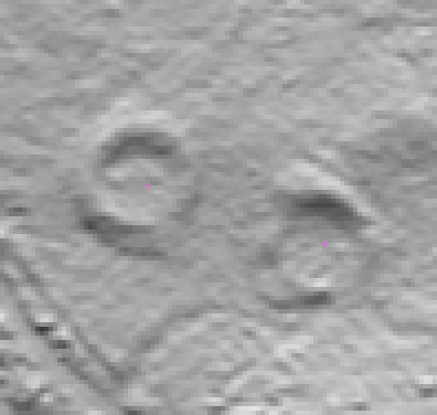
Above: roundhouses.
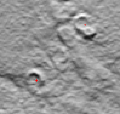
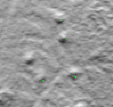
Above: shielings. Below: small cairns.
 Hvordan komme til NR
 Del på sosiale media
 Personvernerklæring